Siesbach
| Siesbach | ||
|---|---|---|
|
||
| Coordinates: 49°43′58″N 7°14′20″E / 49.73278°N 7.23889°ECoordinates: 49°43′58″N 7°14′20″E / 49.73278°N 7.23889°E | ||
| Country | Germany | |
| State | Rhineland-Palatinate | |
| District | Birkenfeld | |
| Municipal assoc. | Birkenfeld | |
| Government | ||
| • Mayor | Dieter Storr | |
| Area | ||
| • Total | 7.43 km2 (2.87 sq mi) | |
| Elevation | 388 m (1,273 ft) | |
| Population (2015-12-31) | ||
| • Total | 386 | |
| • Density | 52/km2 (130/sq mi) | |
| Time zone | CET/CEST (UTC+1/+2) | |
| Postal codes | 55767 | |
| Dialling codes | 06781 | |
| Vehicle registration | BIR | |
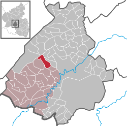
Siesbach is an Ortsgemeinde – a municipality belonging to a Verbandsgemeinde, a kind of collective municipality – in the Birkenfeld district in Rhineland-Palatinate, Germany. It belongs to the Verbandsgemeinde of Birkenfeld, whose seat is in the like-named town.
Siesbach lies in the Naturpark Saar-Hunsrück. The municipal area is 68.3% wooded. The nearest major town is Idar-Oberstein, 3 km to the southeast.
Siesbach borders in the north on the municipality of Sensweiler, in the northeast on the municipality of Hettenrodt, in the east on the municipality of Mackenrodt, in the southeast on the municipality of Rötsweiler-Nockenthal, in the south and southwest on the municipality of Wilzenberg-Hußweiler, in the west on the municipality of Schwollen and in the northwest on the municipality of Allenbach.
The council is made up of 8 council members, who were elected by majority vote at the municipal election held on 7 June 2009, and the honorary mayor as chairman.
Siesbach’s mayor is Hans-Dieter Storr, and his deputies are Rüdiger Mais and Klaus Mildenberger.
The German blazon reads: Über rot-silbern geschachtem Schildfuß in Schwarz vorne ein silbernes Eichblatt mit Eichel, hinten ein silberner beschrifteter Stein.
The municipality’s arms might in English heraldic language be described thus: Sable dexter an oakleaf per bend fructed of one and sinister a border stone inscribed of the field, both argent, the base countercompony gules and argent.
...
Wikipedia


