Shoshoni, Wyoming
| Shoshoni, Wyoming | |
|---|---|
| Town | |

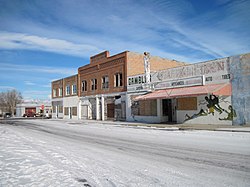
Part of downtown Shoshoni, 2012
|
|
 Location of Shoshoni, Wyoming |
|
| Location in the United States | |
| Coordinates: 43°14′25″N 108°6′52″W / 43.24028°N 108.11444°WCoordinates: 43°14′25″N 108°6′52″W / 43.24028°N 108.11444°W | |
| Country | United States |
| State | Wyoming |
| County | Fremont |
| Area | |
| • Total | 3.58 sq mi (9.27 km2) |
| • Land | 3.58 sq mi (9.27 km2) |
| • Water | 0 sq mi (0 km2) |
| Elevation | 4,843 ft (1,476 m) |
| Population (2010) | |
| • Total | 649 |
| • Estimate (2012) | 664 |
| • Density | 181.3/sq mi (70.0/km2) |
| Time zone | Mountain (MST) (UTC-7) |
| • Summer (DST) | MDT (UTC-6) |
| ZIP code | 82649 |
| Area code(s) | 307 |
| FIPS code | 56-70570 |
| GNIS feature ID | 1594295 |
| Website | shoshoniwyoming.org |
Shoshoni is a town in Fremont County, Wyoming, United States. The population was 649 at the 2010 census. The town is named for the Shoshone tribe of Native Americans, most of whom live on the nearby Wind River Indian Reservation. Although the word is generally spelled 'Shoshone', it is pronounced phonetically as 'Shoshoni'.
Shoshoni is located at 43°14′25″N 108°6′52″W / 43.24028°N 108.11444°W (43.240161, -108.114540).
According to the United States Census Bureau, the town has a total area of 3.58 square miles (9.27 km2), all of it land.
Shoshoni has a continental arid desert climate and is, some years, the driest town in the entire Mountain Time Zone; occasionally it receives less than 4 inches of rainfall annually.
Shoshoni's closest body of water is Boysen Reservoir which is also the confluence of the Wind River, Badwater Creek and Poison Creek. As the water exits the dam it becomes the Big Horn River.
"NOWData - NOAA Online Weather Data". National Oceanic and Atmospheric Administration.
...
Wikipedia

