Shippingport Bridge
| Shippingport Bridge | |
|---|---|

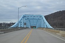
Looking north from the bridge's southern end
|
|
| Coordinates | 40°37′37″N 80°25′56″W / 40.62694°N 80.43222°W |
| Carries | 2 lanes of |
| Crosses | Ohio River |
| Locale | Shippingport and Midland, Pennsylvania |
| Maintained by | PennDOT |
| Characteristics | |
| Design | Cantilevered through truss bridge |
| History | |
| Opened | 1964 |
The Shippingport Bridge is a cantilevered through truss bridge carrying Pennsylvania Route 168 across the Ohio River between Shippingport, Pennsylvania and Industry, Pennsylvania. From 1951 until the opening of the bridge in 1964, PA 168 was accessed across the river via Cooks Ferry.
The southern approach to the bridge is adjacent to the Beaver Valley Nuclear Generating Station.
...
Wikipedia
