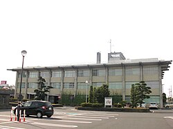
Shimotsuma, Ibaraki
|
Shimotsuma 下妻市 |
|||
|---|---|---|---|
| City | |||

Shimotsuma city hall
|
|||
|
|||
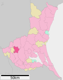
 Location of Shimotsuma in Ibaraki Prefecture |
|||
| Coordinates: 36°11′3.9″N 139°58′2.9″E / 36.184417°N 139.967472°ECoordinates: 36°11′3.9″N 139°58′2.9″E / 36.184417°N 139.967472°E | |||
| Country | Japan | ||
| Region | Kantō | ||
| Prefecture | Ibaraki Prefecture | ||
| Area | |||
| • Total | 80.88 km2 (31.23 sq mi) | ||
| Population (September 2015) | |||
| • Total | 43,207 | ||
| • Density | 534/km2 (1,380/sq mi) | ||
| Time zone | Japan Standard Time (UTC+9) | ||
| - Tree | Pine | ||
| - Flower | Chrysanthemum | ||
| Phone number | 0296-43-2111 | ||
| Address | 2-22Honjo-cho, Shimotsuma-shi, Ibaraki-ken 304-8501 | ||
| Website | Official website | ||
Shimotsuma (下妻市 Shimotsuma-shi?) is a city located in Yūki District, Ibaraki Prefecture, in the northern Kantō region of Japan. As of September 2015, the city had an estimated population of 42,484 and a population density of 236 persons per km². Its total area was 180.06 km².
Shimotsuma is located in western Ibaraki Prefecture. The Kinugawa River flows through the city.
Shimotsuma developed as a castle town from the Muromachi period. It was the center of Shimotsuma Domain under the Tokugawa shogunate during the Edo period. The modern town of Shimotsuma was established on April 1, 1889 with the establishment of the municipalities system. It was elevated to city status on January 1, 1955.
On January 1, 2006, the village of Chiyokawa (from Yūki District) was merged into Shimotsuma.
The economy of Shimotsuma is primarily agricultural.
Shimotsuma has ten elementary schools, three middle schools and two high schools in addition to one special education school. A Brazilian school Escola Pingo de Gente was formerly located in Shimotsuma. It has since been renamed to Instituto Educare and moved to Tsukuba.
...
Wikipedia


