Sherpa Fire
| Sherpa Fire | |
|---|---|

The burn scar of the Sherpa Fire as seen from space on June 19.
|
|
| Location | Santa Barbara County, California |
| Coordinates | 34°31′48″N 120°03′14″W / 34.53°N 120.054°WCoordinates: 34°31′48″N 120°03′14″W / 34.53°N 120.054°W |
| Statistics | |
| Date(s) | June 15, 2016 - July 12, 2016 |
| Burned area | 7,474 acres (30 km2) |
| Cause | Under investigation |
| Injuries | 9 |
| Map | |
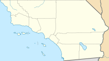
| Location in Southern California | |
The Sherpa Fire was a wildfire that burned in the Santa Ynez Mountains along the Gaviota Coast in the southwestern part of Santa Barbara County, California in June 2016. In a matter of hours the fire spread to over 1,400 acres (570 ha) as the fire was propelled by downslope sundowner winds. This offshore northerly wind contrasts with the more typical onshore flow and sent the fire down the canyons towards the ocean with gusts of over 35 miles per hour (56 km/h). The wildfire resulted in evacuations at two state beach campgrounds and some residences together with intermittent interruption of traffic on a state transportation route.
The fire was first reported shortly before 4:00pm on Wednesday June 15, 2016. in the Los Padres National Forest in an area that includes private inholdings. In a matter of hours the fire had grown to over 1,400 acres (5.7 km2). According to the United States Forest Service, the fire was propelled by downslope sundowner winds which sent the fire down canyons in the Santa Ynez Mountains with gusts of over 35 miles per hour (56 km/h). These contrasted with the typical onshore flow so the fire alternated directions between day and night as it continued to spread. As the fire grew, evacuations were ordered for El Capitán State Beach, Refugio State Beach and residences in El Capitán Canyon. Both a Red Cross evacuation shelter and a livestock evacuation center were established as the fire was burning in an area with a number of large ranches. As the fire ran down the slope, it forced the intermittent closure of the coastal highway designated as U.S. Route 101 and California State Route 1 along with regional and interstate passenger trains and freight service on the adjacent rail line. The fire grew to 4,000 acres (1,600 ha) overnight and destroyed the water system for El Capitán State Beach.
...
Wikipedia

