Sherman, Illinois
| Sherman | |
| Village | |
| Country | United States |
|---|---|
| State | Illinois |
| County | Sangamon |
| Elevation | 598 ft (182 m) |
| Coordinates | 39°53′32″N 89°36′17″W / 39.89222°N 89.60472°WCoordinates: 39°53′32″N 89°36′17″W / 39.89222°N 89.60472°W |
| Area | 3.23 sq mi (8 km2) |
| - land | 3.19 sq mi (8 km2) |
| - water | 0.04 sq mi (0 km2) |
| Population | 4,148 (2010) |
| Density | 933.5/sq mi (360/km2) |
| Village President | Trevor Clatfelter |
| Timezone | CST (UTC-6) |
| - summer (DST) | CDT (UTC-5) |
| Postal code | 62684 |
| Area code | 217 |
|
Location in Sangamon County and the state of Illinois.
|
|
|
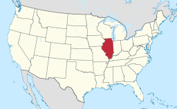
Location of Illinois in the United States
|
|
Sherman is a village in Sangamon County, Illinois, United States. The population was 4,148 at the 2010 census. It is part of the Springfield, Illinois Metropolitan Statistical Area.
Sherman is located at 39°53′32″N 89°36′17″W / 39.892202°N 89.604784°W.
According to the 2010 census, Sherman has a total area of 3.235 square miles (8.38 km2), of which 3.19 square miles (8.26 km2) (or 98.61%) is land and 0.045 square miles (0.12 km2) (or 1.39%) is water.
As of the census of 2000, there were 2,871 people, 962 households, and 771 families residing in the village. The population density was 933.5 people per square mile (359.9/km²). There were 989 housing units at an average density of 321.6 per square mile (124.0/km²). The racial makeup of the village was 97.74% White, 0.31% African American, 0.42% Native American, 1.01% Asian, 0.07% Pacific Islander, 0.03% from other races, and 0.42% from two or more races. Hispanic or Latino of any race were 0.52% of the population.
...
Wikipedia


