Shelley, Idaho
| Shelley, Idaho | |
|---|---|
| City | |
 |
|
 Location of Shelley, Idaho |
|
| Coordinates: 43°22′46″N 112°7′26″W / 43.37944°N 112.12389°WCoordinates: 43°22′46″N 112°7′26″W / 43.37944°N 112.12389°W | |
| Country | United States |
| State | Idaho |
| County | Bingham |
| Area | |
| • Total | 1.81 sq mi (4.69 km2) |
| • Land | 1.81 sq mi (4.69 km2) |
| • Water | 0 sq mi (0 km2) |
| Elevation | 4,633 ft (1,412 m) |
| Population (2010) | |
| • Total | 4,409 |
| • Estimate (2012) | 4,413 |
| • Density | 2,435.9/sq mi (940.5/km2) |
| Time zone | Mountain (MST) (UTC-7) |
| • Summer (DST) | MDT (UTC-6) |
| ZIP code | 83274 |
| Area code(s) | 208 |
| FIPS code | 16-73450 |
| GNIS feature ID | 0397154 |
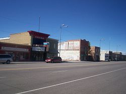
Shelley is a city in Bingham County, Idaho, United States. The population was 4,409 at the 2010 census. The mascot for the city's high school is a russet-burbank potato that wears a crown, robe and scepter.
Since 1927 Shelley has been home to the "Idaho Annual Spud Day", which is celebrated on the 3rd Saturday of September. It typically features a parade, live bands, a Spud Tug, a spud-picking Contest, and free baked potatoes.
Shelley was established in 1904. It was named for John F. Shelley, who moved to the area in 1892. He'd moved to the area intending to open a small store, and needed lumber and other supplies to build it. Since the site was some distance from the nearest existing community, he asked the railroad company to make a special stop to offload the supplies he'd ordered. They consented, provided he could offload the supplies in under 20 minutes. His daughter, Lottie, wrote the following in her personal history:
With the help of Chris Mickelson and others, the lumber was thrown off the train on both sides of the track. Later a spur was put in here by the railroad company.
Now they needed a name for the town. Mother suggested 'Shelco'; Father said, 'Shelton,' so they drew cuts and Mother won." Shelco was submitted to the railroad company and they replied: 'Call your town what you wish, but we have already named the spur, Shelley '.
John F. Shelley
John F. Shelley and his wife stand in the background. In the foreground are the rest of his family: Mary, Tom, Charlotte (Lottie), Docia, Hannah Davis
On September 4, 1902 a large fire destroyed seven buildings on State Street. Only two buildings, a general merchandise store and Nalder's furniture store, were saved. Soren Yorgensen, a local Justice of the Peace and proprieter of the first hotel in Shelley recounts the experience as follows:
...One windy afternoon in the heat of the summer, a fire started in a small grocery store operated by James Jensen. It did not take long until the wind was fanning a flame that wiped out quite a long string of frame buildings - two saloons, restaurant, Odd Fellows Hall, Post Office and Confectionery, Grocery Store, and dwelling.
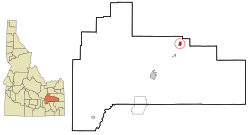
Shelley is located at 43°22′46″N 112°7′26″W / 43.37944°N 112.12389°W (43.379490, -112.123846).
...
Wikipedia
