Sheberghan airport
| Sheberghan Airport د شبرغان هوائی ډګر | |||||||||||||||
|---|---|---|---|---|---|---|---|---|---|---|---|---|---|---|---|
| Summary | |||||||||||||||
| Airport type | Public | ||||||||||||||
| Operator | Afghanistan Ministry of Transport and Civil Aviation | ||||||||||||||
| Location | Sheberghan, Afghanistan | ||||||||||||||
| Elevation AMSL | 1,100 ft / 335 m | ||||||||||||||
| Coordinates | 36°45′4.7″N 65°54′45.3″E / 36.751306°N 65.912583°ECoordinates: 36°45′4.7″N 65°54′45.3″E / 36.751306°N 65.912583°E | ||||||||||||||
| Map | |||||||||||||||
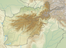
| Location of airport in Afghanistan | |||||||||||||||
| Runways | |||||||||||||||
|
|||||||||||||||
|
Sources: Landings.com
|
|||||||||||||||
Sheberghan Airfield (ICAO: OASG) is located in the Jowzjan Province in the northwest part of Afghanistan. The airfield is located in a plain adjacent to a river, 17 nautical miles (31 km) northeast of Sheberghan, 12 nautical miles (22 km) west of Aqchah, and 40 nautical miles (74 km) east of Andkhoy.
The airport resides at an elevation of 1,100 feet (335 m) above mean sea level. It has two parallel runways: 06L/24R with an asphalt surface measuring 8,600 by 80 feet (2,621 m × 24 m) and 06R/24L with a gravel surface measuring 6,939 by 100 feet (2,115 m × 30 m).
The downward sloping runway is gravel base with a small cement run-up pad at the south end. The runway is slightly damaged. There aren't any facilities.
...
Wikipedia

