Sharda Temple
| Sharada Peeth شاردا پیٹھ |
|
|---|---|

Ruins of the Sharada Peeth
|
|
|
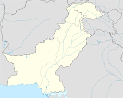
Location in Pakistan administered Kashmir
|
|
| Geography | |
| Coordinates | 34°47′35″N 74°11′19″E / 34.79306°N 74.18861°ECoordinates: 34°47′35″N 74°11′19″E / 34.79306°N 74.18861°E |
| Location |
Pakistan |
| Culture | |
| Sanctum | Sharada (Saraswati) |
Sharada Peeth (Urdu: شاردا پیٹھ) is an abandoned Hindu temple located in the village of Sharda, along the Neelam River in Azad Kashmir. It is situated near the militarily-sensitive Line of Control which divides Pakistani administered Kashmir from Indian administered Kashmir.
Sharada Peeth was a major centre of learning, and is regarded as one of 18 Maha Shakti Peethas, or a "Grand Shakti Peethas" – which are highly revered temples throughout South Asia that commemorate the location of fallen body parts of the Hindu deity Sati. Sharada Peeth is traditionally believed to be the site where the right hand of Sati is said to have fallen after being carried by her husband Shiva.
The temple is located in the remote village of Sharda, in Neelam Valley, at a distance of 60 miles from Baramulla and 40 miles from Muzaffarabad, and 70 miles from Srinagar. It lies 16 miles to the northwest of the Line of Control in a militarily sensitive area. The temple is at a height of 11000 feet above the sea level.
The Chinese Buddhist monk, Xuanzang, visited this learning centre in 632 CE. He stayed there for two years and appreciated the mental gifts of priests and students of this learning centre.Kalhana wrote that during Lalitaditya's reign in the 8th century CE, some followers of a king of Gauda in Bengal came to Kashmir under the pretext of visiting the shrine, highlighting the significance of the temple throughout South Asia.
...
Wikipedia

