Seward Park (Seattle)
| Seward Park | |
|---|---|

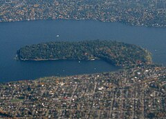
Aerial view of Seward Park from the west, with Mercer Island on top and Seattle on bottom.
|
|
|
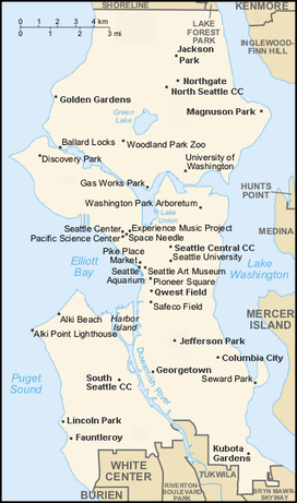
Location of Seward Park in Seattle
|
|
| Type | Urban park |
| Location | Seattle, Washington |
| Coordinates | 47°33′22″N 122°15′04″W / 47.556°N 122.251°WCoordinates: 47°33′22″N 122°15′04″W / 47.556°N 122.251°W |
| Area | 300 acres (120 ha; 0.47 sq mi) |
| Established | 1911 |
| Founder | E. O. Schwagerl |
| Designer | Olmsted Brothers |
| Operated by | City of Seattle |
| Open | 6 am – 10 pm |
| Website | Seattle Parks and Recreation: Seward Park |
Seward Park is a municipal park which covers 300 acres (120 ha; 0.47 sq mi). It is located in southeast Seattle, Washington, U.S.A in the neighborhood of the same name. The park occupies all of Bailey Peninsula, a forested peninsula that juts into Lake Washington. It contains one of the last surviving tracts of old-growth forest within the city of Seattle. The park is named for U.S. Secretary of State William Seward.
One approaches the park from the north by Lake Washington Boulevard S, from the south by Seward Park Avenue S., or from the west by S Orcas Street. The main parking lot and a tennis court are located in the southwest corner. The most commonly used trail is a car-free loop around the park. It is flat and 2.4 mi (3.9 km). The perimeter trail was repaved in 2007. Other trails run through the interior, including a few car-accessible roads that lead to amenities including an amphitheater and picnic area. Seward Park features numerous small beaches, the largest one on its southwest side, as well as a playground and an arts center.
The 300 acres (120 ha) of Seward Park have about a 120 acres (49 ha) surviving remnant of old growth forest, providing a glimpse of what some of the lake shore looked like before the city of Seattle. With trees older than 250 years and many less than 200, the Seward Park forest is relatively young (the forests of Seattle before the city was fully mature, were up through 1,000–2,000 years old).
The area has been inhabited since the end of the last glacial period (c. 8000 BCE—10,000 years ago). The People of the Large Lake (Xacuabš or hah-chu-AHBSH, today the Duwamish tribe) had resource sites; villages were nearby. The Duwamish called Bailey Peninsula "Noses" (Lushootseed: squbáqst) for rocky points, or "noses", at the north and south ends evident before the completion of the Lake Washington Ship Canal in 1916 lowered the level of Lake Washington. The marshy isthmus was called cka’lapsEb, Lushootseed for “neck”.
...
Wikipedia

