Sequoia National Forest
| Sequoia National Forest | |
|---|---|
|
IUCN category VI (protected area with sustainable use of natural resources)
|
|

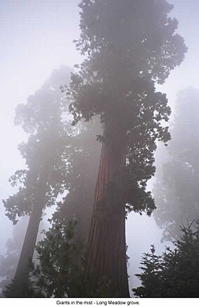
Long Meadow Grove on a misty day
|
|
| Location | Tulare / Kern / Fresno counties, California, US |
| Nearest city | Bakersfield, CA / Porterville, CA / |
| Coordinates | 36°2′24″N 118°30′16″W / 36.04000°N 118.50444°WCoordinates: 36°2′24″N 118°30′16″W / 36.04000°N 118.50444°W |
| Area | 1,193,315 acres (4,829.17 km2) |
| Established | 1908 |
| Governing body | U.S. Forest Service |
| Website | Sequoia National Forest |
Sequoia National Forest is located in the southern Sierra Nevada mountains of California. The U.S. National Forest is named for the majestic Giant Sequoia (Sequoiadendron giganteum) trees which populate 38 distinct groves within the boundaries of the forest.
The Giant Sequoia National Monument is located in the national forest. Other notable features include glacier-carved landscapes and impressive granite monoliths. The Needles are a series of granite spires atop a narrow ridge above the Kern River. Forest headquarters are located in Porterville, California. There are local ranger district offices in Dunlap, Kernville, Lake Isabella, and Springville.
The Sequoia National Forest covers 1,193,315 acres (1,864.555 sq mi; 4,829.17 km2), and ranges in elevation from 1,000 feet (300 m) in the foothills of the Sierra Nevada to over 12,000 feet (3,700 m). Its Giant Sequoia (Sequoiadendron giganteum) groves are part of its 196,000 acres (790 km2) of old growth forests. Other tree species include:
The Needles are a series of granite spires atop a narrow ridge above the Kern River.(36°07′17″N 118°30′16″W / 36.1214°N 118.5044°W)
...
Wikipedia

