Septfontaines
|
Septfontaines Simmer |
||
|---|---|---|
| Commune | ||
 |
||
|
||
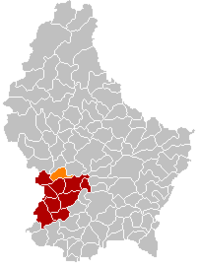
 Map of Luxembourg with Septfontaines highlighted in orange, and the canton in dark red |
||
| Coordinates: 49°42′01″N 5°57′57″E / 49.700278°N 5.965833°ECoordinates: 49°42′01″N 5°57′57″E / 49.700278°N 5.965833°E | ||
| Country |
|
|
| Canton | Capellen | |
| Government | ||
| • Mayor | Yves Even | |
| Area | ||
| • Total | 14.96 km2 (5.78 sq mi) | |
| Area rank | 80 of 105 | |
| Highest elevation | 391 m (1,283 ft) | |
| • Rank | 60th of 105 | |
| Lowest elevation | 247 m (810 ft) | |
| • Rank | 58th of 105 | |
| Population (2014) | ||
| • Total | 833 | |
| • Rank | 104th of 105 | |
| • Density | 56/km2 (140/sq mi) | |
| • Density rank | 85th of 105 | |
| Time zone | CET (UTC+1) | |
| • Summer (DST) | CEST (UTC+2) | |
| LAU 2 | LU00009010 | |
| Website | septfontaines.lu | |
Septfontaines (Luxembourgish: Simmer, German: Simmern) is a commune and small town in western Luxembourg. It is part of the canton of Capellen, which is part of the district of Luxembourg. As of 2001[update], the town of Septfontaines, which lies in the centre of the commune, has a population of 356. Other towns within the commune include Greisch and Roodt-sur-Eisch.
Septfontaines Castle is one of the castles belonging to the Valley of the Seven Castles. Located high above the village of Septfontaines, the medieval castle is now privately owned.
The name Septfontaines is a French neologism (the local population is almost entirely Luxembourgish-speaking), derived from the older name Siebenborn (literally, 'seven springs'), which appears as the name of the town in Latin and German documents from the nineteenth century and earlier. This name is also seen in Siewebueren, the name of the town's fountain. The name Siebenborn was often abbreviated 7born in vital records.
...
Wikipedia

