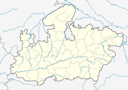
Seondha
| Seondha | |
|---|---|
| city | |
| Location in Madhya Pradesh, India | |
| Coordinates: 26°10′N 78°47′E / 26.16°N 78.78°ECoordinates: 26°10′N 78°47′E / 26.16°N 78.78°E | |
| Country |
|
| State | Madhya Pradesh |
| District | Datia |
| Elevation | 152 m (499 ft) |
| Population (2001) | |
| • Total | 19,540 |
| Languages | |
| • Official | Hindi |
| Time zone | IST (UTC+5:30) |
| ISO 3166 code | IN-MP |
| Vehicle registration | MP |
| Website | www.facebook.com/seondha |
Seondha is a town and a nagar panchayat in Datia district in the Indian state of Madhya Pradesh. A large Datia era fortress, is located in the town along the banks of the Sindh River.
Seondha is located at 26°10′N 78°47′E / 26.16°N 78.78°E. It has an average elevation of 152 metres (498 feet). Sun Kuwa is the famous place in Seondha because after dewali fair (mela) is conducted on purnima and people take baths on this day. After taking a bath all persons feel better. It is situated at edge of Sindh River.
Seondha experiences warm and temperate climate. In winter, there is much less rainfall than in summer. The Köppen-Geiger climate classification is Cwa. The average temperature in Seondha is 26.0 °C. The average annual rainfall is 881 mm. The driest month is April. There is 2 mm of precipitation in April. Most precipitation falls in August, with an average of 305 mm.
As of 2001[update] India census, Seondha had a population of 19,540. Males constitute 55% of the population and females 45%. Seondha has an average literacy rate of 60%, higher than the national average of 59.5%: male literacy is 69%, and female literacy is 49%. In Seondha, 16% of the population is under 6 years of age.
...
Wikipedia


