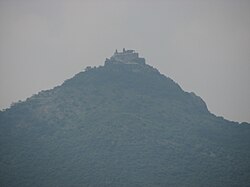
Sendamangalam
| Sendamangalam | |
|---|---|
| Taluk | |
 |
|
| Location in Tamil Nadu, India | |
| Coordinates: 11°18′00″N 78°14′00″E / 11.3000°N 78.2333°ECoordinates: 11°18′00″N 78°14′00″E / 11.3000°N 78.2333°E | |
| Country |
|
| State | Tamil Nadu |
| District | Namakkal |
| Elevation | 240 m (790 ft) |
| Population (2001) | |
| • Total | 18,085 |
| Languages | |
| • Official | Tamil |
| Time zone | IST (UTC+5:30) |
| PIN | 637409 |
| Telephone code | 91-4286 |
| Vehicle registration | TN-28 |
Sendamangalam is a Taluk in the Indian state of Tamil Nadu is situated in Namakkal District.
Sendamangalam is located at 11°18′00″N 78°14′00″E / 11.3000°N 78.2333°E. It has an average elevation of 240 metres (715 feet). It is close to Kolli Hills (கொல்லி மலை) - which is part of the Eastern Ghats (கிழக்கு தொடர்ச்சிமலை). The closest river is Kaveri (காவேரி). The city is approximately 350 km southwest of Chennai, 255 km south of Bangalore, 50 km south of Salem and 93 km northwest of Tiruchirapalli (Trichy).
Between CE. 1216 and 1279 CE, Sendamangalam was the capital of the Kadava kings Kopperunchinga I & Kopperunchinga II, who converted it into a military stronghold and fought successfully against Kulothunga Chola III and Rajaraja Chola III, against successive Hoysala kings, and against Jatavarman Sundara Pandyan. The Kadavas remained friendly with the Magadai/Aragalur chief 'Magadan Rajarajadevan pon parappinan Magadaipprumal' and the Tirukoilur chief Malayaman. Their kingdom was eradicated by the campaigns of Maaravarman Kulasekara Pandyan I. After the fall of Hoysalas, Vijayanagar Empire, Madurai Nayak ruled this part by Poligar Ramachandra Nayakar.This place was famous for nainamalai temple.
...
Wikipedia

