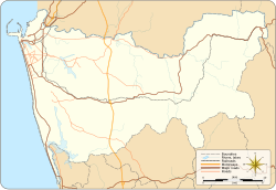
Seethawakapura
|
Avissawella Seethawakapura |
|
|---|---|
| Town | |
| Coordinates: 6°57′11″N 80°13′06″E / 6.95306°N 80.21833°ECoordinates: 6°57′11″N 80°13′06″E / 6.95306°N 80.21833°E | |
| Country | Sri Lanka |
| Province | Western Province |
| Time zone | Sri Lanka Standard Time Zone (UTC+5:30) |
| • Summer (DST) | Summer time (UTC+6) |
Avissawella, (අවිස්සාවේල්ල in Sinhala, அவிசாவளை in Tamil) is a township in Sri Lanka, governed by an Urban Council, situated on the A4 route from Colombo to Ratnapura, Colombo District, Western Province, Sri Lanka, approximately 59 km east of capital Colombo. It is also known as Seethawakapura.
It is on the periphery of the Western Province on its border with the Sabaragamuwa Province.
This town has a rich and proud history in the annals of its military exploits against the Portuguese invaders as it was the capital of Sitawaka Kingdom from 1521 to 1593. Seethawaka was ruled by King Mayadunne and later his son Rajasinghe the First during this period. There is a lore that Rajasinghe was a parricide but some historians discount this as a story spread by jealousy.
Avissawella is the junction from where the oldest land route to the Hill Country via Hatton and the road down South via Ratnapura diverge. The Kelani Valley Railway line was originally built from Colombo to Yatiyanthota via Avissawella during 1900–1902. It was branched off at Avissawella and extended up to Opanayaka via Ratnapura (completed in 1912). Originally it was built as a 2 ft 6 in (762 mm) narrow-gauge[1] line to serve the rubber plantations in the area. The railway line between Avissawella and Yatiyanthota was removed in 1942, and the line from Homagama to Opanayaka abandoned in 1973. The railway services were restarted up to Avissawella in 1978 and is now a broad gauge line.
...
Wikipedia

