Sebastian-Vero Beach, Florida Metropolitan Statistical Area
| Indian River County, Florida | ||
|---|---|---|

Indian River County Courthouse in Vero Beach
|
||
|
||
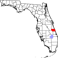
 Location in the U.S. state of Florida |
||
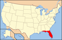
 Florida's location in the U.S. |
||
| Founded | May 30, 1925 | |
| Named for | Indian River Lagoon | |
| Seat | Vero Beach | |
| Area | ||
| • Total | 617 sq mi (1,598 km2) | |
| • Land | 503 sq mi (1,303 km2) | |
| • Water | 114 sq mi (295 km2), 18.5% | |
| Population (est.) | ||
| • (2015) | 147,919 | |
| • Density | 274/sq mi (106/km²) | |
| Congressional district | 8th | |
| Time zone | Eastern: UTC-5/-4 | |
| Website | www |
|
Indian River County is a county located in the Treasure Coast region of the U.S. state of Florida. As of the 2010 census, the population was 138,028. Its county seat is Vero Beach. It is Florida's 7th richest county and in 2000 was the 87th richest county in the U.S. by per capita income.
Indian River County comprises the Sebastian-Vero Beach, Florida Metropolitan Statistical Area, which is included in the Miami-Fort Lauderdale-Port St. Lucie, Florida Combined Statistical Area.
Prior to 1821 the area of Indian River County was part of the Spanish colony of East Florida. In 1822 this area became part of St. Johns County, in 1824 it became part of Mosquito County (original name of Orange County), and in 1844 its portion of Mosquito County became part of newly created St. Lucia County. In 1855 St. Lucia County was renamed Brevard County. In 1905 St. Lucie County was formed from the southern portion of Brevard County; in 1925 Indian River County was formed from the northern portion of St. Lucie County. It was named for the Indian River Lagoon, which runs through the eastern portion of the county.
According to the U.S. Census Bureau, the county has a total area of 617 square miles (1,600 km2), of which 503 square miles (1,300 km2) is land and 114 square miles (300 km2) (18.5%) is water.
As of the census of 2000, there were 112,947 people, 49,137 households, and 32,725 families residing in the county. The population density was 224 people per square mile (87/km²). There were 57,902 housing units at an average density of 115 per square mile (44/km²). The racial makeup of the county was 87.43% White, 8.19% Black or African American, 0.25% Native American, 0.74% Asian, 0.03% Pacific Islander, 2.15% from other races, and 1.21% from two or more races. 6.53% of the population were Hispanic or Latino of any race.
...
Wikipedia

