Schwarzheide
| Schwarzheide | ||
|---|---|---|
 |
||
|
||
| Coordinates: 51°28′59″N 13°52′00″E / 51.48306°N 13.86667°ECoordinates: 51°28′59″N 13°52′00″E / 51.48306°N 13.86667°E | ||
| Country | Germany | |
| State | Brandenburg | |
| District | Oberspreewald-Lausitz | |
| Government | ||
| • Mayor | Christoph Schmidt (Ind.) | |
| Area | ||
| • Total | 33.23 km2 (12.83 sq mi) | |
| Population (2015-12-31) | ||
| • Total | 5,795 | |
| • Density | 170/km2 (450/sq mi) | |
| Time zone | CET/CEST (UTC+1/+2) | |
| Postal codes | 01987 | |
| Dialling codes | 035752 | |
| Vehicle registration | OSL (to 1994 SFB) | |
| Website | www.schwarzheide.de | |
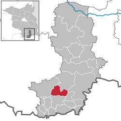
Schwarzheide is a town in the Oberspreewald-Lausitz district, in southern Brandenburg, Germany. It is situated on the river Schwarze Elster, 11 km southwest of Senftenberg, 110 km south of Berlin and 40 km north of Dresden. The little river Pössnitz runs through the eastern part of Schwarzheide.
Immediate neighbors of the town are the towns Ruhland (south), Lauchhammer (west), Schipkau (north) and Senftenberg with the district Brieske (east).
Schwarzheide has the following districts
The town's landmark is the watertower. Today´s industrial town, Schwarzheide, was created on October 1, 1936, from the independent communities, Zschornegosda (today Schwarzheide-West) and Naundorf (now part of Schwarzheide-Ost). The name was translated from the Sorbian name, "Zschornegosda", (corny = black, gozd = heath, wood). The date of foundation of this community is unknown. Zschornegosda and Naundorf were founded in the 12th or the 13th century after the Christianization of the Sorbs.
The first written evidence of Naundorf (as Nuwendorff) came from a pledge deed from 1421. Zschornegosda was first written in 1449 (as Cschörnegast) in feudal deed of Duke Frederick II, Elector of Saxony. Naundorf is a typical street village. Zschornegosda is a rotunde called okolnica. The chapel was on the highest point of a sandy knoll.
The development of both villages was retarded by wars, fires, and epidemics. Until the 18th century, the villages had no more than 100 inhabitants.
In 1780, the discovery of lignite coal west of Zschornegosda in Bockwitz lead to mining and the foundation of briquette factories (Ferdinand, Victoria, Victoria II). The river, Schwarze Elster, was drained and converted to a canal, so it was no longer possible to live from fishing. Highway A13 was built in 1936.
...
Wikipedia


