Schull
|
Skull Schull Scoil Mhuire / an Scoil
|
|
|---|---|
| Town | |

Main Street
|
|
| Location in Ireland | |
| Coordinates: 51°31′36″N 9°32′53″W / 51.5266°N 9.5481°WCoordinates: 51°31′36″N 9°32′53″W / 51.5266°N 9.5481°W | |
| Country | Ireland |
| Province | Munster |
| County | County Cork |
| Population (2011) | |
| • Urban | 658 |
| Time zone | WET (UTC+0) |
| • Summer (DST) | IST (WEST) (UTC-1) |
| Irish Grid Reference | V924317 |
| Website | www |
| Skull is the official spelling. | |
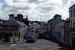
Schull or Skull (/ˈskʌl/ SKUL; Irish: Scoil Mhuire or An Scoil, meaning "Mary's School") is a town in County Cork, Ireland. The name derives from a medieval monastic school, of which no trace remains.
Located on the southwest coast, in West Cork, the village is situated in a scenic and remote location, dominated by Mount Gabriel (407 m). It has a sheltered harbour, used for recreational boating. The area, on the peninsula leading to Mizen Head, is popular with tourists, and there are numerous holiday homes along the adjoining coast. The village had a population of 693 in 2002. The town's secondary school, Schull Community College, houses one of the only planetariums in Ireland along with a sailing school. Each year Schull harbour hosts the Fastnet International Schools Regatta.
Schull once had its own railway station. The village was the western terminus of the Schull and Skibbereen Railway, a steam-operated narrow gauge railway; it was closed by CIÉ in 1947. Schull railway station opened on 6 September 1886, closed for passenger and goods traffic on 27 January 1947, and finally closed altogether on 1 June 1953.
The townlands of Schull Parish include:
...
Wikipedia

