Schlieben
| Schlieben | ||
|---|---|---|

General view of Schlieben with
the bell tower of historic St Martins Church |
||
|
||
| Coordinates: 51°43′00″N 13°22′59″E / 51.71667°N 13.38306°ECoordinates: 51°43′00″N 13°22′59″E / 51.71667°N 13.38306°E | ||
| Country | Germany | |
| State | Brandenburg | |
| District | Elbe-Elster | |
| Municipal assoc. | Schlieben | |
| Government | ||
| • Mayor | Helmut Richter (SPD) | |
| Area | ||
| • Total | 78.22 km2 (30.20 sq mi) | |
| Elevation | 89 m (292 ft) | |
| Population (2015-12-31) | ||
| • Total | 2,452 | |
| • Density | 31/km2 (81/sq mi) | |
| Time zone | CET/CEST (UTC+1/+2) | |
| Postal codes | 04936 | |
| Dialling codes | 035361 | |
| Vehicle registration | EE | |
| Website | www.schlieben.com | |
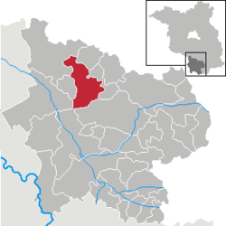
Schlieben is a town in the Elbe-Elster district, in southwestern Brandenburg, Germany. It is situated 22 km north of Bad Liebenwerda. Schlieben was the site of a concentration camp during the Holocaust.
...
Wikipedia


