Sauget, Illinois
| Sauget | |
| Village | |
| Country | United States |
|---|---|
| State | Illinois |
| County | St. Clair |
| Coordinates | 38°35′13″N 90°10′0″W / 38.58694°N 90.16667°WCoordinates: 38°35′13″N 90°10′0″W / 38.58694°N 90.16667°W |
| Area | 4.59 sq mi (12 km2) |
| - land | 4.23 sq mi (11 km2) |
| - water | 0.36 sq mi (1 km2) |
| Population | 159 (2010) |
| Density | 60.3/sq mi (23/km2) |
| Timezone | CST (UTC-6) |
| - summer (DST) | CDT (UTC-5) |
| Postal code | 62201 / 62206 |
| Area code | 618 |
|
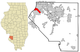
Location in St. Clair County and the state of Illinois.
|
|
|
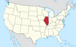
Location of Illinois in the United States
|
|
Sauget (/sɔːˈʒeɪ/ saw-ZHAY) is a village in St. Clair County, Illinois, United States. It is part of Greater St. Louis. The population was 159 at the 2010 census, down from 249 in 2000.
Sauget is located at 38°35′13″N 90°10′0″W / 38.58694°N 90.16667°W (38.587013, -90.166690).
According to the 2010 census, Sauget has a total area of 4.594 square miles (11.90 km2), of which 4.23 square miles (10.96 km2) (or 92.08%) is land and 0.364 square miles (0.94 km2) (or 7.92%) is water.
Sauget is located in the American Bottom, the floodplain of the Mississippi River opposite St. Louis, Missouri.
Sauget was incorporated as "Monsanto" in 1926. It was formed to provide a lighter regulatory environment and low taxes for the Monsanto chemical plants at a time when local jurisdictions had most of the responsibility for environmental rules. It was renamed in honor of Leo Sauget, its first Village President.
...
Wikipedia


