Sauge
| Sauge | ||
|---|---|---|

Frinvillier village main street
|
||
|
||
| Coordinates: 47°11′N 7°18′E / 47.183°N 7.300°ECoordinates: 47°11′N 7°18′E / 47.183°N 7.300°E | ||
| Country | Switzerland | |
| Canton | Bern | |
| District | Jura bernois | |
| Government | ||
| • Mayor | Maire | |
| Area | ||
| • Total | 13.44 km2 (5.19 sq mi) | |
| Population (Dec 2015) | ||
| • Total | 810 | |
| • Density | 60/km2 (160/sq mi) | |
| Postal code | 2536-37 | |
| SFOS number | 0449 | |
| Surrounded by | Orvin, Péry, Romont, Pieterlen, Biel/Bienne | |
| Website |
http://www.sauge-jb.ch/ SFSO statistics |
|
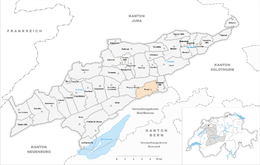
Sauge is a municipality in the Jura bernois administrative district in the canton of Bern in Switzerland. It is located in the French-speaking Bernese Jura (Jura Bernois). On 1 January 2014 the former municipalities of Plagne and Vauffelin merged into the municipality of Sauge.
Plagne is first mentioned in 1311 as Blenn, though this comes from a 1441 copy of the original document. In 1610 it was mentioned as Plaentsch. The municipality was formerly known by its German name Plentsch, however, that name is no longer used.
In 1311 Plagne was part of a fief owned by the Basel Cathedral that was granted to Bourkard de La Roche. It was part of the seigniory of Erguel which was owned by the Prince Bishop of Basel. After the 1797 French victory and the Treaty of Campo Formio, Plagne became part of the French Département of Mont-Terrible. A few years later, it became part of the Département of Haut-Rhin. After Napoleon's defeat and the Congress of Vienna, Plagne was assigned to the Canton of Bern in 1815. In 1862 a fire destroyed the village core and it had to be rebuilt in the following years.
During the Early Modern Era, in addition to agriculture, some of the residents mined a small ore deposit south of Les Ferrières or mined white pottery clay. At the end of the 18th Century many residents began making watch parts in home workshops. Beginning in the 1970s the village's population grew rapidly as commuters to Biel/Bienne moved out to Plagne.
...
Wikipedia


