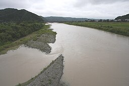
Saru River
| Saru River (Saru-gawa) | |
| 沙流川 | |
| River | |
| Country | Japan |
|---|---|
| State | Hokkaidō |
| Region | Hidaka Subprefecture |
| District | Saru District |
| Municipalities | Biratori, Hidaka |
| Source | Mount Kumami |
| - location | Hidaka, Hidaka Subprefecture, Japan |
| - elevation | 930 m (3,051 ft) |
| - coordinates | 42°58′59″N 142°45′8″E / 42.98306°N 142.75222°E |
| Mouth | Pacific Ocean |
| - location | Hidaka, Hidaka Subprefecture, Japan |
| - elevation | 0 m (0 ft) |
| - coordinates | 42°30′5″N 142°0′31″E / 42.50139°N 142.00861°ECoordinates: 42°30′5″N 142°0′31″E / 42.50139°N 142.00861°E |
| Length | 104 km (65 mi) |
| Basin | 1,350 km2 (521 sq mi) |
Saru River (沙流川 Saru-gawa?) is a river in Hokkaidō, Japan.
The Saru River rises in the Hidaka Mountains and empties into the Pacific. The Nibutani Dam is situated on the Saru River, at Nibutani village. The construction of this dam was the subject of famous domestic litigation, producing the first ever Japanese legal decision to recognise the Ainu people as an indigenous people. Construction of a second dam, the Biratori Dam is also planned by the Hokkaido Development Board. The 'Cultural Landscape along the Saru River resulting from Ainu Tradition and Modern Settlement' has been designated an Important Cultural Landscape.
...
Wikipedia

