Sariwŏn
|
Sariwŏn 사리원시 |
|
|---|---|
| Municipal city | |
| transcription(s) | |
| • Chosŏn'gŭl | 사리원시 |
| • Hancha | |
| • McCune–Reischauer | Sariwŏn-si |
| • Revised Romanization | Sariwon-si |
 |
|
| Coordinates: 38°30′28″N 125°45′16″E / 38.50778°N 125.75444°E | |
| Country |
|
| Province | North Hwanghae Province |
| Population | |
| • Total | est. 310,100 |
| Time zone | Korea Standard Time (UTC+9) |
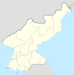
Sariwŏn (Korean pronunciation: [sa.ɾi.wʌn]) is the capital of North Hwanghae Province, North Korea. The city's population is estimated to be 310,100 people.
Sariwŏn is divided into 31 tong (neighbourhoods) and 9 ri (villages):
Sariwŏn has the only pediatric hospital in the entire region; it serves 16 districts and 500,000 children and teens annually.
Sariwŏn has a Potassic/Potash Fertilizer Complex and a tractor factory.
Educational institutions include the University of Agriculture, University of Geology, University of Medicine, University of Education nos. 1 & 2 and the Sariwŏn Pharmaceutical College of Koryŏ.
The "Sariwŏn Folklore street" was constructed during Kim-Jong-il's rule. Built to display an ideal picture of ancient Korea, it includes buildings in the "historical style" and a collection of ancient Korean cannons. Although it is considered an inaccurate romanticized recreation of an ancient Korean street, it is frequently used as a destination for foreigners on official government tours. Many older style Korean buildings exist in the city.
Sariwŏn is served by Sariwŏn Ch'ŏngnyŏn and several other stations on both the P'yŏngbu and Hwanghae Ch'ŏngnyŏn lines of the Korean State Railway.
Coordinates: 38°30′23″N 125°45′35″E / 38.50639°N 125.75972°E
...
Wikipedia

