Santo Amaro, Bahia
| Santo Amaro | |||
|---|---|---|---|
| Municipality | |||
|
|||
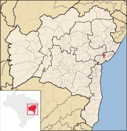
 Location in Bahia state |
|||
| Location in Brazil | |||
| Coordinates: 12°32′49″S 38°42′43″W / 12.54694°S 38.71194°WCoordinates: 12°32′49″S 38°42′43″W / 12.54694°S 38.71194°W | |||
| Country |
|
||
| Region | Northeast Region | ||
| State | Bahia | ||
| Mesoregion | Metropolitana de Salvador | ||
| Area | |||
| • Total | 492.9 km2 (190.3 sq mi) | ||
| Population (2015) | |||
| • Total | 61,702 | ||
| • Density | 130/km2 (320/sq mi) | ||
| Time zone | BRT (UTC-3) | ||
Santo Amaro, also known as Santo Amaro da Purificação is a municipality in the state of Bahia in Brazil. The population is 61,702 (2015 est.) in an area of 492.9 km². It is a suburb of Salvador and it is located in the metropolitan area of Salvador.
Santo Amaro da Purificação, located about 73 kilometres (45 mi) from the city of Salvador, was formerly established as a sugar production center and now contains the historic remnants of its past, including its most famous church, the Igreja Matriz Santo Amaro da Purificação. Other historic structures include the remains of the mansions of former sugar barons and a municipal palace built in 1769. The area is noted for its nearby beautiful beaches, the Falls of Vitória, and the grotto of Bom Jesus dos Pobres. The town features prominently in the novel The War of the Saints by Jorge Amado.
A cholera epidemic occurred in 1855, killing approximately 50,000 in Santo Amaro and in Salvador, Bahia. Doctor Cypriano Barbosa Bettâmio gave his life leading efforts to combat the disease.
According to the Brazilian Census of 2010, Santo Amaro is 77% Roman Catholic, 22% Evangelical, and 1% Spiritist. The statistics do not take into account Candomblé practitioners. Santo Amaro has both a large number of Candomblé terreiros (60) and a long tradition of religious syncretism between Candomblé and Roman Catholicism.
...
Wikipedia


