Santa Fe Springs, CA
| Santa Fe Springs, California | ||
|---|---|---|
| City | ||
| City of Santa Fe Springs | ||

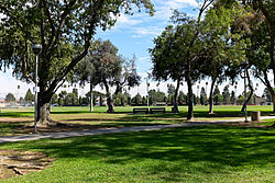
Little Lake Park, Santa Fe Springs
|
||
|
||
 Location of Santa Fe Springs in Los Angeles County, California |
||
| Location in the United States | ||
| Coordinates: 33°56′15″N 118°4′2″W / 33.93750°N 118.06722°WCoordinates: 33°56′15″N 118°4′2″W / 33.93750°N 118.06722°W | ||
| Country | ||
| State |
|
|
| County |
|
|
| Incorporated | May 15, 1957 | |
| Government | ||
| • Mayor | Richard J. Moore | |
| Area | ||
| • Total | 8.914 sq mi (23.088 km2) | |
| • Land | 8.874 sq mi (22.985 km2) | |
| • Water | 0.040 sq mi (0.103 km2) 0.45% | |
| Elevation | 135 ft (41 m) | |
| Population (2010) | ||
| • Total | 16,223 | |
| • Density | 1,800/sq mi (700/km2) | |
| Time zone | Pacific (UTC-8) | |
| • Summer (DST) | PDT (UTC-7) | |
| ZIP codes | 90605, 90670, 90671 | |
| Area code | 562 | |
| FIPS code | 06-69154 | |
| GNIS feature ID | 1661404 | |
| Website | www |
|
Santa Fe Springs is a city in Los Angeles County, California, United States. It is one of the Gateway Cities of southeast Los Angeles County. The population was 16,223 at the 2010 census, down from 17,438 at the 2000 census.
Santa Fe Springs is located at 33°56′15″N 118°04′02″W / 33.937443°N 118.067155°W.
According to the United States Census Bureau, the city has a total area of 8.9 square miles (23 km2). 8.9 square miles (23 km2) of it is land and 0.04 square miles (0.10 km2) of it (0.45%) is water.
It is bordered by the unincorporated West Whittier-Los Nietos to the north, Pico Rivera to the northwest, Downey to the west, Norwalk to the southwest, Cerritos to the south, La Mirada and the unincorporated South Whittier to the east, and Whittier to the northeast.
In 1907, the Union Oil Company of California began drilling near the intersection of Norwalk Blvd. and Telegraph Road, locally known as "Four Corners," with the spudding in of the Meyer No. 1 well. That well, and a subsequent one, failed. In 1921 the Union-Bell well blew in as a 2,500-barrel gusher and set off an oil rush by major oil companies and fly-by-night producers. Within a year the Santa Fe Springs oil field was considered one of the richest pools in petroleum history. Santa Fe Springs became a promoters' paradise. Prospective investors were bused into the field, served a free lunch in circus tents, and told stories about the fortunes made in oil. In 1923 the state legislature limited the amount of stock that could be sold in a well.
...
Wikipedia


