Sanpete
| Sanpete County, Utah | |
|---|---|

Sanpete County Courthouse
|
|
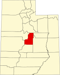
 Location in the U.S. state of Utah |
|
 Utah's location in the U.S. |
|
| Founded | 1850 |
| Named for | Chief Sanpitch |
| Seat | Manti |
| Largest city | Ephraim |
| Area | |
| • Total | 1,603 sq mi (4,152 km2) |
| • Land | 1,590 sq mi (4,118 km2) |
| • Water | 12 sq mi (31 km2), 0.8% |
| Population | |
| • (2010) | 27,822 |
| • Density | 17/sq mi (7/km²) |
| Congressional districts | 2nd, 4th |
| Time zone | Mountain: UTC-7/-6 |
| Website | sanpete |
Sanpete County is a county located in the U.S. state of Utah. As of the 2010 census, the population was 27,822. Its county seat is Manti, and its largest city is Ephraim. The county was created in 1850. It was named for the Ute chief Sanpitch, which was changed to Sanpete. According to William Bright, the name comes from the Ute word saimpitsi, meaning "people of the tules".
On June 14, 1849, Ute chiefs Walkara and Sowiette went to the Salt Lake Valley to ask Mormon leader Brigham Young to settle a group of his people in the valley of Sanpitch, about 125 miles (201 km) to the south. Wanting to honor their request and needing to found new settlements where the quickly-growing population of Salt Lake could expand, Brigham Young sent a party to explore the area in August of that year. It was deemed favorable to settlement, and Brigham Young called Isaac Morley and George Washington Bradley to organize about fifty families to move south and settle "San Pete."
The settlers arrived in the valley on November 19, 1849. They numbered 224 men, women, and children and were led by Isaac Morley, Charles Shumway, and Seth Taft and George Washington Bradley. After some debate, the first settlement in the valley was established on the present site of Manti, Utah.
Over the course of the 19th Century, many of the settlers came from Scandinavian countries, as documented in the Saga of the Sanpitch.
According to the U.S. Census Bureau, the county has a total area of 1,603 square miles (4,150 km2), of which 1,590 square miles (4,100 km2) is land and 12 square miles (31 km2) (0.8%) is water. The geographical center of Utah is located in Sanpete County, just west of Ephraim.
Sanpete County is bounded along its eastern side by the Wasatch Plateau (sometimes known as the Manti Mountains). The Wasatch Plateau rises to elevations of approximately 11,000 feet (3,300 m). Most of the Wasatch Plateau is encompassed by the Manti Division of the Manti-La Sal National Forest. Runoff from the western slopes of these mountains provides water to the county's cities and agricultural areas. Central Sanpete is dominated by the Sanpete Valley (sometimes known as the Sanpitch Valley), where most of the county's cities are located. The western side of the valley is bounded by the lower and drier San Pitch Mountains, which also form part of the western boundary of the county. The San Pitch River, runs from north to south through Sanpete and empties into the Sevier River in southwestern Sanpete. This portion of the Sevier River Valley is known as Gunnison Valley.
...
Wikipedia
