San Rafael, Argentina
| San Rafael | |
|---|---|
| City | |

San Rafael
|
|
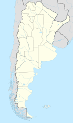
| Location of San Rafael in Argentina | |
| Coordinates: 34°36′S 68°20′W / 34.600°S 68.333°WCoordinates: 34°36′S 68°20′W / 34.600°S 68.333°W | |
| Country |
|
| Province | Mendoza |
| Department | San Rafael |
| Founded | April 2, 1805 |
| Government | |
| • Mayor | Emir Roberto Felix |
| Elevation | 750 m (2,460 ft) |
| Population (2012) | |
| • Total | 118,950 |
| Demonym(s) | sanrafaelino |
| Time zone | ART (UTC-3) |
| CPA base | M5600 |
| Dialing code | +54 2627 |
| Climate | BSk |
| Website | Official website |
San Rafael is a city in the southern region of the Mendoza Province, Argentina. With more than 170,000 inhabitants (2001 census [INDEC]), it is the largest city and the seat of San Rafael Department.
The city is located 240 km from the provincial capital and 990 km from the federal capital. Natural attractions in the area include the Diamante River, which flows through the city, the rapids-strewn Atuel River just south and Lake Los Reyunos, 20 km (12 mi) west of San Rafael.
Spanish expeditions led by Francisco de Villagra from what today is Chile first surveyed the area in 1551 and, finding a well-established agricultural Coquimbo and Diaguita cultures, they rapidly subdued the existing peoples and expropriated the land. Displaced Pehuenches revolted, however, and repeated attacks led to an 1804 treaty signed by Viceroy Rafael de Sobremonte whereby the Pehuenches ceded land to colonial authorities. The construction of Fort San Rafael del Diamante and its 2 April 1805 completion marked the formal establishment of San Rafael.
San Rafael remained relatively isolated from the rest of the country, long after independence in 1816. The area's agricultural potential and strategic location were eventually brought to the federal government's attention. In 1871, civil engineer Julio Balloffet was commissioned to oversee the development of San Rafael. His efforts were centered around needed public works, among which were civic buildings, schools, plazas, a hospital, cathedral and irrigation works. The irrigation canals were accompanied by an agricultural laboratory and a panel of agronomists and, by 1900, the San Rafael area fruit orchards had attracted a sizable contingent of Italian and French immigrants.
...
Wikipedia

