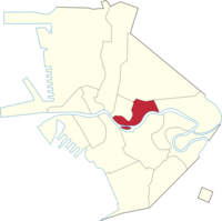
San Miguel, Manila
| City | Manila |
|---|---|
| Population (2007) | 16,120 |
| – Density | per km² |
| Area | km² |
| – Barangays | 12 |
| – Cong. Districts | 6th District |
San Miguel is a primarily middle-class residential area of the City of Manila, and is one of the city's sixteen traditional districts.
Malacañang Palace, the official residence of the President of the Philippines, is located in the neighbourhood, and outside the Palace gates is Mendiola Street, a popular site for protests against the government.
The San Miguel district is also home to some colleges and universities that form part of Manila's "University Belt" which encompasses San Miguel, and the districts of Quiapo and Sampaloc. Educational institutions that are located in the district include Far Eastern University, San Beda College, Centro Escolar University, College of the Holy Spirit, Saint Jude Catholic School, La Consolacion College Manila and Victorino Mapa High School.
San Miguel is also the place where San Miguel Beer was originally produced, beginning in the Spanish colonial era. The brewery's buildings were demolished after the property was transferred to the state, and it today forms part of the Palace complex.
...
Wikipedia

