San Leandro
| San Leandro, California | |
|---|---|
| City | |

San Leandro Marina
|
|
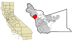
 Location within Alameda County |
|
| Location in the United States | |
| Coordinates: 37°43′30″N 122°09′22″W / 37.72500°N 122.15611°WCoordinates: 37°43′30″N 122°09′22″W / 37.72500°N 122.15611°W | |
| Country |
|
| State |
|
| County | Alameda County |
| Incorporated | March 21, 1872 |
| Government | |
| • Mayor | Pauline Russo Cutter (D) |
| • City Manager | Chris Zapata |
| • State Senate | Nancy Skinner (D) |
| • State Assembly | Rob Bonta (D) |
| • U. S. Congress | Barbara Lee (D) |
| Area | |
| • Total | 15.663 sq mi (40.565 km2) |
| • Land | 13.343 sq mi (34.557 km2) |
| • Water | 2.320 sq mi (6.008 km2) 14.81% |
| Elevation | 56 ft (15 m) |
| Population (2014) | |
| • Total | 86,869 |
| • Estimate (January 1, 2016) | 87,700 |
| • Density | 6,366.6/sq mi (2,458.6/km2) |
| Time zone | Pacific Standard Time Zone (UTC-8) |
| • Summer (DST) | Pacific Daylight Time (UTC-7) |
| ZIP codes | 94577-94579 |
| Area code(s) | 510 |
| FIPS code | 06-68084 |
| GNIS feature IDs | 232427, 1659582, 2411794 |
| Website | www |
San Leandro is a suburban city in Alameda County, California, United States. It is located on the eastern shore of San Francisco Bay, between Oakland to the northwest and Hayward to the southeast.
The first inhabitants of the geographic region which would eventually become San Leandro were the ancestors of the Ohlone people, who arrived sometime between 3500 and 2500 BC.
The Spanish settlers called these natives Costeños or "coast people" and the English-speaking settlers called them Costanoans. San Leandro was first visited by Europeans on March 20, 1772 by Spanish soldier Captain Pedro Fages and the Spanish Catholic priest Father Crespi.
San Leandro is located on the Rancho San Leandro and Rancho San Antonio Mexican land grants. Both were located along El Camino Viejo, modern 14th Street / State Route 185.
The smaller, Rancho San Leandro, approximately 9,000 acres (3,600 ha), was given to José Joaquín Estudillo in 1842. The larger, Rancho San Antonio, approximately 44,000 acres (18,000 ha) was given to another Spanish soldier Don Luis Maria Peralta in 1820. Beginning in 1855, two of Estudillo's sons-in-law, John B. Ward and William Heath Davis, laid out the town site that would become San Leandro, bounded by the San Leandro Creek on the north, Watkins Street on the east, Castro Street on the south, & on the west by the longitude lying a block west of Alvarado Street. The city has a historic Portuguese population dating from when immigrants from the Azores and laborers from Hawaii began settling in the city in the 1880s and established farms and businesses. By the 1910 census, they had accounted for nearly two-thirds of San Leandro's population.
...
Wikipedia

