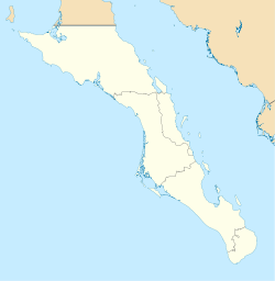
San José del Cabo
| San José del Cabo | |
|---|---|

Downtown San José del Cabo (2012)
|
|
| Location in Baja California Sur | |
| Coordinates: 23°03′41″N 109°42′29″W / 23.06139°N 109.70806°WCoordinates: 23°03′41″N 109°42′29″W / 23.06139°N 109.70806°W | |
| Country |
|
| State | Baja California Sur |
| Municipality | Los Cabos |
| Elevation | 45 m (148 ft) |
| Population (2010) | |
| • Total | 69,788 |
| Time zone | MST (UTC−7) |
| • Summer (DST) | MDT (UTC−6) |
San José del Cabo (Spanish pronunciation: [san xo'se ðel 'kaβo], Saint Joseph of the Cape) is a city located in southern Baja California Sur state, Mexico. It is the seat of Los Cabos Municipality.
In the 2010 census, it had a population of 69,788. Together with neighboring Cabo San Lucas, it forms a major tourist destination for travelers, with over 900,000 hotel guests in 2011. The two cities are served by Los Cabos International Airport.
The Mission San José del Cabo was founded in 1730; the nearby Río San José was useful to the Spanish as a source of fresh water for galleons traveling to and from the Philippines.
San José del Cabo is one of two places where the rare and possibly extinct rice rat Oryzomys peninsulae has been found.
San José del Cabo, like almost all of the Baja California peninsula, has an arid climate (Köppen BWh) although it does receive more rainfall than most areas further north due to tropical cyclones occasionally coming in from the south and bringing very heavy falls such as 340 millimetres (13.4 in) on the first of September 1998 and 316 millimetres (12.4 in) on 3 November 1993. Overall, however, rainfall is some of the most erratic anywhere in the world due to this influence, and many years pass by without significant falls at all.
The sea experiences lows of 72–73 °F (22–23 °C) in winter, and highs of 77–84 °F (25–29 °C) during the summer months.
23 °C
22 °C
...
Wikipedia

