San Fernando, Cebu
| San Fernando | |
|---|---|
| Municipality | |

San Fernando Municipal Hall
|
|
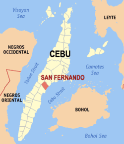
 Map of Cebu with San Fernando highlighted |
|
| Location within the Philippines | |
| Coordinates: 10°10′N 123°42′E / 10.17°N 123.7°ECoordinates: 10°10′N 123°42′E / 10.17°N 123.7°E | |
| Country | Philippines |
| Region | Central Visayas (Region VII) |
| Province | Cebu |
| District | 1st district of Cebu |
| Barangay | 21 (see § Barangays) |
| Government | |
| • Type | Sangguniang Bayan |
| • Mayor | Lakambini Reluya (LP) |
| • Vice mayor | BB Sabalones |
| • Town Council |
Members
|
| • Representative | Gerald Gullas |
| Area | |
| • Total | 69.39 km2 (26.79 sq mi) |
| Population (2015 census) | |
| • Total | 66,280 |
| • Density | 960/km2 (2,500/sq mi) |
| • Voter (2016) | 43,398 |
| Time zone | PST (UTC+8) |
| ZIP code | 6018 |
| IDD : area code | +63 (0)32 |
| Income class | 2nd class |
| PSGC | 072241000 |
San Fernando is a 2nd municipal income class municipality in the province of Cebu, Philippines. According to the 2015 census, it has a population of 66,280. In the 2016 electoral roll, it had 43,398 registered voters.
San Fernando lies within Metro Cebu.
San Fernando comprises 21 barangays:
In the 2016 electoral roll, it had 43,398 registered voters, meaning that 65% of the population are aged 18 and over.
...
Wikipedia

