San Cristobal de las Casas
|
San Cristóbal de las Casas Jovel |
||
|---|---|---|
| Town & Municipality | ||

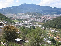
View of the city from the surrounding hillsides.
|
||
|
||
| Location in Mexico | ||
| Coordinates: 16°44′12″N 92°38′18″W / 16.73667°N 92.63833°WCoordinates: 16°44′12″N 92°38′18″W / 16.73667°N 92.63833°W | ||
| Country |
|
|
| State | Chiapas | |
| Founded | 1528 | |
| Municipal Status | 1915 | |
| Government | ||
| Area | ||
| • Municipality | 484 km2 (187 sq mi) | |
| Elevation (of seat) | 2,200 m (7,200 ft) | |
| Population (2010) Municipality | ||
| • Municipality | 185,917 | |
| • Seat | 158,027 | |
| Time zone | CST (UTC-6) | |
| Postal code (of seat) | 29200 | |
| Website |
www |
|
San Cristóbal de las Casas (Spanish ![]() [saŋkɾisˈtoβal de las ˈkasas] ), also known by its native Tzotzil name, Jovel (pronounced [xɤ̞ˈve̞l]), is a town and municipality located in the Central Highlands region of the Mexican state of Chiapas. It was the capital of the state until 1892, and is still considered the cultural capital of Chiapas.
[saŋkɾisˈtoβal de las ˈkasas] ), also known by its native Tzotzil name, Jovel (pronounced [xɤ̞ˈve̞l]), is a town and municipality located in the Central Highlands region of the Mexican state of Chiapas. It was the capital of the state until 1892, and is still considered the cultural capital of Chiapas.
The municipality is mostly made up of mountainous terrain, but the city sits in a small valley surrounded by hills. The city’s center maintains its Spanish colonial layout and much of its architecture, with red tile roofs, cobblestone streets and wrought iron balconies often with flowers. Most of the city’s economy is based on commerce, services and tourism. Tourism is based on the city’s history, culture and indigenous population, although the tourism itself has affected the city, giving it foreign elements. Major landmarks of the city include the Cathedral, the Santo Domingo church with its large open air crafts market and the Casa Na Bolom museum. The municipality has suffered severe deforestation, but it has natural attractions such as caves and rivers.
San Cristóbal de las Casas is a city and municipality located in the Central Highlands region of Chiapas. As a municipality, the city functions as the governmental authority for 83 other rural communities outside the city proper, which cover a territory of 484 km2. Of these communities, the most important include La Candelaria, San Antonio del Monte, Mitziton, San José Yashitinin, El Pinar, Buenavista, Pedernal, Corazon de Maria and Zacualpa Ecatepec. The municipality borders the municipalities of Chamula, Tenejapa, Huixtán, Teopisca, Totolapa, Chiapilla, San Lucas and Zinacantán.
...
Wikipedia


