San Antonio Bay
| San Antonio Bay | |
|---|---|

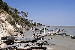
The shore of San Antonio Bay
|
|

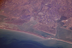
View from the International Space Station
|
|
| Location | Texas Gulf Coast |
| Coordinates | 28°18′19″N 96°44′17″W / 28.30528°N 96.73806°W |
| River sources | Guadalupe River |
| Ocean/sea sources | Gulf of Mexico |
| Basin countries | United States |
San Antonio Bay is a bay on the Texas Gulf coast situated between Matagorda and Aransas Bay. It consists mainly of the combined waters of the San Antonio and Guadalupe rivers, and is located at the mouth of the Guadalupe River, about 55 miles (89 km) northeast of Corpus Christi and 130 miles (209 km) southeast of San Antonio. It is protected from the Gulf of Mexico by Matagorda Island, leaving only relatively small and distant outlets to the Gulf for little mixing of bay and Gulf waters. The remoteness of the bay has prevented the establishment of major ports as seen on Aransas and Corpus Christi Bay, to the south.
The Aransas National Wildlife Refuge is found on the southwest portion of the bay. The diverse wildlife on these shores make up for the lack of a sizable human settlement.
The Karankawa Indians used the land near the Guadalupe River delta and San Antonio Bay for camping purposes. They also populated Matagorda Island on the opposite side of the bay. Captain Luis Cazorla of Presidio La Bahía crossed San Antonio Bay to visit the island in 1776, and discovered that the Indians had killed the mates of a shipwrecked British trading vessel. For a short time, he convinced the Indian leaders not to kill shipwreck survivors on the island. An effort was made to convert the Indians with the establishment of Mission Refugio on San Antonio Bay in 1793, after Fray José Francisco Garza found a shallow crossing that the Indians used to travel to the mainland. To prevent the Indians from using Matagorda Island as a hiding place to stage attacks, La Bahía commandant Juan Cortés burned and cut brush around the point of crossing. No permanent colony was ever established on the island.
...
Wikipedia
