Samarrah
|
Samarra سامَرّاء |
|
|---|---|
| City | |
| Sāmarrā' | |

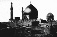
The Shrine of two Shiʿi Imams in Samarra.
|
|
| Coordinates: 34°11′54″N 43°52′27″E / 34.19833°N 43.87417°E | |
| Country |
|
| Governorate | Saladin Governorate |
| Population (2003 est) | |
| • Total | 348,700 |
| Official name | Samarra Archaeological City |
| Type | Cultural |
| Criteria | ii, iii, iv |
| Designated | 2007 (33rd session) |
| Reference no. | 276 |
| State Party |
|
| Region | Arab States |
| Endangered | 2007–present |
Coordinates: 34°11′54″N 43°52′27″E / 34.19833°N 43.87417°E
Sāmarrā (Arabic: سامَرّاء) is a city in Iraq. It stands on the east bank of the Tigris in the Saladin Governorate, 125 kilometers (78 mi) north of Baghdad. In 2003 the city had an estimated population of 348,700. Samarra was once in the "Sunni Triangle" of violence during the sectarian violence in Iraq (2006–07).
In the medieval times, Samarra was the capital of the Abbasid Caliphate and the only remaining Islamic capital that retains its original plan, architecture and artistic relics. In 2007, UNESCO named Samarra one of its World Heritage Sites.
The remains of prehistoric Samarra were first excavated between 1911 and 1914 by the German archaeologist Ernst Herzfeld. Samarra became the type site for the Samarra culture. Since 1946, the notebooks, letters, unpublished excavation reports and photographs have been in the Freer Gallery of Art in Washington, DC.
...
Wikipedia

