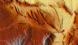
Samangan
| Samangan | |
|---|---|
 Location of Samangan. Click to see. |
|
| Location in Afghanistan | |
| Coordinates: 36°15′55″N 68°1′0″E / 36.26528°N 68.01667°ECoordinates: 36°15′55″N 68°1′0″E / 36.26528°N 68.01667°E | |
| Country |
|
| Province | Samangan Province |
| District | Aybak District |
| Elevation | 959 m (3,146 ft) |
| Population (2012) | |
| • Total | 9,958 |
| Time zone | + 4.30 |
Samangan (previous: Eukratidia; then Aybak or Aibak) is a provincial town, medieval caravan stop, and the headquarters of the Samangan Province in the district of the same name in the northern part of Afghanistan. As an ancient town and major Buddhist centre during the 4th and 5th centuries under the then Kushan rulers, it has the ruins of that period at a place known now as Takht-e-Rustam, which is located on a hill above the town.
The earliest known history is linked to the identification of the place by Ptolemy as the place of the Varni or Uarni and the fortified city of Samangan on the banks of the Khulm River, identical to the city on the Dargydus River, south east of Zariaspa/Balkh. The ruins found here establish the city's founding by Eucratides I, the King of Bactria. It was then known as Eukratidia, the size of the present Khulm city.
Historicity of the town is dated to the Kushan Dynasty reign during the 4th and 5th centuries when it was a famous Buddhist centre. Witness to this period is seen now in the form of ruins at a place called the Takht-e-Rostam, which is located 3 km from the town on a hilltop. Arabs and Mongols came to this place when it was already famous as a Buddhist religious centre.
Takt-e Rostam is a historical place where ruins of Buddhist religious culture could be seen. The Buddhist stupa here in the form of a mound, located on the hilltop, represents the earliest link to the evolution of Buddhist architecture.
Aibak was the name given to this place when during the medieval period, caravans used to stop here.
Samangan has one of the well-known archaeological sites in Afghanistan, in the Takth i Rostam and the adjacent Buddhist caves and stupas on top of a hill, north of Hindu Kush passes. At this location, caves were hewn out of rocks and inhabited by Buddhists. The Buddhist stupa here is in the form of a mound. It represents the earliest link to the evolution of Buddhist architecture in Afghanistan. Another heritage site is the Hazar Sumuch District which is about 10 km away from the town.
...
Wikipedia

