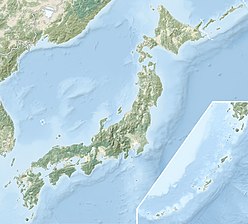
Sakura-jima
| Sakurajima | |
|---|---|

View of Sakurajima from mainland Kagoshima, 2009
|
|
| Highest point | |
| Elevation | 1,117 m (3,665 ft) |
| Coordinates | 31°35′N 130°39′E / 31.583°N 130.650°ECoordinates: 31°35′N 130°39′E / 31.583°N 130.650°E |
| Geography | |
|
Kagoshima Prefecture, Japan
|
|
| Geology | |
| Mountain type | composite volcano |
| Last eruption | 1955 to 2018 (Ongoing) |
| Date | January 1914 |
|---|---|
| Type | Peléan |
| VEI | 4 |
| Impact | Pre-eruption earthquakes killed at least 35 people and an additional 23 people died; caused an evacuation and significant changes to the local topography. |
Sakurajima (Japanese: 桜島, lit. "Cherry blossom Island") is an active composite volcano and a former island in Kagoshima Prefecture in Kyushu, Japan. The lava flows of the 1914 eruption connected it with the Osumi Peninsula.
The volcanic activity still continues, dropping volcanic ash on the surroundings. Earlier eruptions built the white sands highlands in the region. The most recent eruption started on May 2, 2017. On September 13, 2016 a team of experts from Bristol University and the Sakurajima Volcano Research Centre in Japan suggested that the volcano could have a major eruption within 30 years.
Sakurajima is a stratovolcano. Its summit has three peaks, Kita-dake (northern peak), Naka-dake (central peak) and Minami-dake (southern peak) which is active now.
Kita-dake is Sakurajima's highest peak, rising to 1,117 m (3,665 ft) above sea level. The mountain is located in a part of Kagoshima Bay known as Kinkō-wan. The former island is part of the city of Kagoshima. The surface of this volcanic peninsula is about 77 km2 (30 sq mi).
Sakurajima is located in the Aira caldera and formed in an enormous eruption 22,000 years ago. Several hundred cubic kilometres of ash and pumice were ejected, causing the magma chamber underneath the erupting vents to collapse. The resulting caldera is over 20 km (12 mi) across. Tephra fell as far as 1,000 km (620 mi) from the volcano. Sakurajima is a modern active vent of the same Aira caldera volcano.
...
Wikipedia

