Sainte-Croix (Vaud)
| Sainte-Croix | ||
|---|---|---|

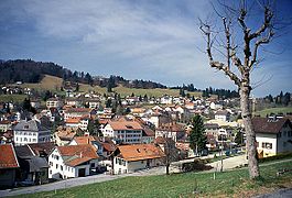
View of the city from the south
|
||
|
||
| Coordinates: 46°49′N 06°30′E / 46.817°N 6.500°ECoordinates: 46°49′N 06°30′E / 46.817°N 6.500°E | ||
| Country | Switzerland | |
| Canton | Vaud | |
| District | Jura-Nord Vaudois | |
| Government | ||
| • Mayor | Syndic | |
| Area | ||
| • Total | 39.42 km2 (15.22 sq mi) | |
| Elevation | 1,086 m (3,563 ft) | |
| Population (Dec 2016) | ||
| • Total | 4,912 | |
| • Density | 120/km2 (320/sq mi) | |
| Postal code | 1450 | |
| SFOS number | 5568 | |
| Surrounded by | Baulmes, Bullet, Buttes (NE), Fiez, La Côte-aux-Fées (NE), Les Fourgs (FR-25), Les Hôpitaux-Vieux (FR-25), Vuiteboeuf | |
| Website |
www Profile (in French), SFSO statistics |
|
Sainte-Croix is a municipality in the district of Jura-Nord Vaudois in the canton of Vaud in Switzerland.
Sainte-Croix is first mentioned in 1177 as Sancta Crux. In 1317 it was mentioned as Saint Crueyz. Previously it was known by its German name Heilig Kreuz.
Sainte-Croix has an area, as of 2009[update], of 39.42 square kilometers (15.22 sq mi). Of this area, 16.21 km2 (6.26 sq mi) or 41.1% is used for agricultural purposes, while 19.57 km2 (7.56 sq mi) or 49.6% is forested. Of the rest of the land, 2.74 km2 (1.06 sq mi) or 7.0% is settled (buildings or roads), 0.1 km2 (25 acres) or 0.3% is either rivers or lakes and 0.69 km2 (0.27 sq mi) or 1.8% is unproductive land.
Of the built up area, housing and buildings made up 3.6% and transportation infrastructure made up 2.6%. Out of the forested land, 45.9% of the total land area is heavily forested and 3.8% is covered with orchards or small clusters of trees. Of the agricultural land, 1.0% is used for growing crops and 21.2% is pastures and 18.9% is used for alpine pastures. All the water in the municipality is flowing water.
The municipality was part of the Grandson District until it was dissolved on 31 August 2006, and Sainte-Croix became part of the new district of Jura-Nord Vaudois.
It is located between Yverdon in Vaud, Fleurier in Neuchâtel, and Pontarlier in France.
The village of Sainte Croix is situated at an altitude of 1,086 meters (3,563 ft) in the Jura Mountains at the foot of the Chasseron. The municipal area stretches over two valleys, Sainte Croix and Les Granges and includes 27 villages. Some of the most notable include Sainte Croix, L' Auberson, La Gitte Dessous, La Chaux, La Vraconne, La Sagne and Le Château.
...
Wikipedia


