Saint Croix, United States Virgin Islands
| Nickname: Twin City | |
|---|---|

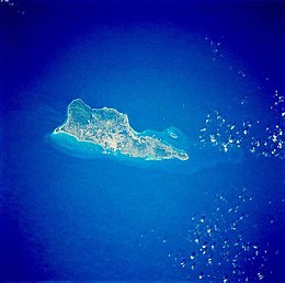
Saint Croix from space, January 1992
|
|
| Geography | |
| Location | Caribbean Sea |
| Coordinates | 17°44′23″N 64°44′20″W / 17.73972°N 64.73889°WCoordinates: 17°44′23″N 64°44′20″W / 17.73972°N 64.73889°W |
| Archipelago | Virgin Islands, Leeward Islands |
| Area | 82.88 sq mi (214.7 km2) |
| Length | 22 mi (35 km) |
| Width | 7 mi (11 km) |
| Highest elevation | 1,165 ft (355.1 m) |
| Highest point | Mount Eagle |
| Administration | |
| Territory | Virgin Islands |
| District | District Of Saint Croix |
| Demographics | |
| Demonym | Crucian |
| Population | 50,601 (2010) |
| Pop. density | 610 /sq mi (236 /km2) |
| Ethnic groups | Afro-Caribbean, Puerto Rican, Caucasian |
Saint Croix (/ˌseɪnt ˈkrɔɪ/; Spanish: Santa Cruz; Dutch: Sint-Kruis; French: Sainte-Croix; Danish and Norwegian: Sankt Croix, Taino: Ay Ay) is an island in the Caribbean Sea, and a county and constituent district of the United States Virgin Islands (USVI), an unincorporated territory of the United States.
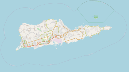
With its 84 square miles, St. Croix is the largest of the islands in the territory. However, the territory's capital, Charlotte Amalie, is located on Saint Thomas. As of the 2010 United States Census, St. Croix's population was 50,600, its highest point is Mount Eagle, at 355 metres (1,165 ft). St. Croix's nickname is "Twin City", for its two towns on opposite ends of the island, Frederiksted on the western end and Christiansted on the east.
...
Wikipedia


