Saint-Prex
| Saint-Prex | ||
|---|---|---|

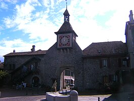
Town gate of Sant-Prex
|
||
|
||
| Coordinates: 46°29′N 06°28′E / 46.483°N 6.467°ECoordinates: 46°29′N 06°28′E / 46.483°N 6.467°E | ||
| Country | Switzerland | |
| Canton | Vaud | |
| District | Morges | |
| Government | ||
| • Mayor |
Syndic Daniel Mosini St-Preyards |
|
| Area | ||
| • Total | 5.52 km2 (2.13 sq mi) | |
| Elevation | 377 m (1,237 ft) | |
| Population (Dec 2015) | ||
| • Total | 5,603 | |
| • Density | 1,000/km2 (2,600/sq mi) | |
| Postal code | 1162 | |
| SFOS number | 5646 | |
| Surrounded by | Buchillon, Etoy, Lully, Lussy-sur-Morges, Publier (FR-74), Thonon-les-Bains (FR-74), Tolochenaz, Villars-sous-Yens | |
| Website |
www Profile (French), SFSO statistics |
|
Saint-Prex is a municipality in the Swiss canton of Vaud, located in the district of Morges.
In 1973, St-Prex was awarded the Wakker Prize for the development and preservation of its architectural heritage.
Saint-Prex is first mentioned in 885 as Sanctus Prothasius.
The town was founded with the construction of the chateau in 1234AD. The bourg (old town) forms a peninsula extending from the north shore of Lake Geneva. In recent years the commerce of the town has mostly moved to outer areas. St-Prex is a port for the CGN lake steamers in summer.
Saint-Prex has an area, as of 2009[update], of 5.5 square kilometers (2.1 sq mi). Of this area, 2.9 km2 (1.1 sq mi) or 52.5% is used for agricultural purposes, while 0.46 km2 (0.18 sq mi) or 8.3% is forested. Of the rest of the land, 2.12 km2 (0.82 sq mi) or 38.4% is settled (buildings or roads), 0.02 km2 (4.9 acres) or 0.4% is either rivers or lakes.
Of the built up area, industrial buildings made up 2.9% of the total area while housing and buildings made up 20.8% and transportation infrastructure made up 9.2%. Power and water infrastructure as well as other special developed areas made up 2.5% of the area while parks, green belts and sports fields made up 2.9%. Out of the forested land, all of the forested land area is covered with heavy forests. Of the agricultural land, 36.2% is used for growing crops and 2.5% is pastures, while 13.8% is used for orchards or vine crops. All the water in the municipality is in lakes.
The municipality was part of the Morges District until it was dissolved on 31 August 2006, and Saint-Prex became part of the new district of Morges.
The municipality is located along Lake Geneva. It consists of the village of Saint-Prex and the hamlets of Les Iles, Beaufort, Senaugin and Fraidaigue. The currently abandoned villages of Dracy and Marcy are also in the municipal area.
...
Wikipedia


