Saginaw County, Michigan
| Saginaw County, Michigan | ||
|---|---|---|

Saginaw County Governmental Center in Saginaw
|
||
|
||
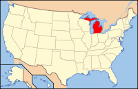
 Location in the U.S. state of Michigan |
||
 Michigan's location in the U.S. |
||
| Founded | February 9, 1835 | |
| Seat | Saginaw | |
| Largest city | Saginaw | |
| Area | ||
| • Total | 816 sq mi (2,113 km2) | |
| • Land | 800 sq mi (2,072 km2) | |
| • Water | 16 sq mi (41 km2), 1.9% | |
| Population | ||
| • (2010) | 200,169 | |
| • Density | 250/sq mi (97/km²) | |
| Congressional districts | 4th, 5th | |
| Time zone | Eastern: UTC-5/-4 | |
| Website | www |
|
Saginaw County, officially the County of Saginaw, is a county located in the U.S. state of Michigan. As of the 2010 census, the population was 200,169. The county seat is Saginaw. The county was created by September 10, 1822, and was fully organized on February 9, 1835. The etymology of the county's name is uncertain. It may be derived from Sace-nong or Sak-e-nong (English: Sauk land), as the Sauk (French: Sac) tribe once lived there. Another possibility is that it comes from Ojibwe words meaning "place of the outlet" –sag (English: an opening) and ong (English: place of).See List of Michigan county name etymologies.
Saginaw County comprises the Saginaw, MI Metropolitan Statistical Area and is included in the Saginaw-Midland-Bay City Combined Statistical Area in the Mid/Central Michigan region.
What is today Saginaw County was inhabited by the Ojibwe before they were driven out by Euro-Americans. The Ojibwe were still the dominant force in the area in the 1820s and in 1827 they were attacked by a two groups of Winnebago people coming from Wisconsin. The Ojibwe prevailed in this fight with the aid of local Euro-American settlers.
In 1853 the Ojibwe and Ottawa both established large hunting camps along the Saginaw River, although Euro-American settlers were beginning saw mills and farms in the area by that point.
...
Wikipedia

