Sadsbury Township, Chester County, Pennsylvania
| Sadsbury Township | |
| Township | |
|
Houses along US 30
|
|
| Country | United States |
|---|---|
| State | Pennsylvania |
| County | Chester |
| Elevation | 581 ft (177.1 m) |
| Coordinates | 39°58′40″N 75°53′57″W / 39.97778°N 75.89917°WCoordinates: 39°58′40″N 75°53′57″W / 39.97778°N 75.89917°W |
| Area | 6.2 sq mi (16.1 km2) |
| - land | 6.17 sq mi (16 km2) |
| - water | 0.03 sq mi (0 km2), 0.48% |
| Population | 3,570 (2010) |
| Density | 578.6/sq mi (223.4/km2) |
| Timezone | EST (UTC-5) |
| - summer (DST) | EDT (UTC-4) |
| Area code | 610 |
| Code 2 | 484 |
|
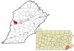
Location in Chester County and the state of Pennsylvania.
|
|
|
Location of Pennsylvania in the United States
|
|
| Website: http://www.sadsburytwp.org | |
Sadsbury Township is a township in Chester County, Pennsylvania, United States. The population was 3,570 at the 2010 census.
According to the United States Census Bureau, the township has a total land area of 6.17 square miles (16.0 km2) with a total water area of 0.03 square miles (0.078 km2). It includes the village of Sadsburyville in the north, and the census-designated place of Pomeroy in the south.
The township of Sadsbury was organized in 1717. In 1728, it was divided into West Sadsbury Township and East Sadsbury Township. East Sadsbury Township was reduced in size by the creation of Valley Township in 1852, the borough of Parkesburg in 1872 and the borough of Atglen in 1875. The final division came with the erection of West Sadsbury in 1878, with the remainder being Sadsbury Township in its current form.
As of the census of 2010, there were 3,570 people, 1,311 households, and 988 families residing in the township. There were 1,361 housing units, of which 1,311 were occupied. The racial makeup of the township was 84.5% White, 8.5% African American, 2.6% Asian, 0.3% Native American, 0.1% Pacific Islander, 1.2% from other races, and 2.9% from two or more races. Hispanic or Latino of any race were 4.1% of the population.
...
Wikipedia


