Sør-Vågsøy
| Sør-Vågsøy herad | |
|---|---|
| Former Municipality | |

Måløy village
|
|
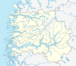
| Location in Sogn og Fjordane county | |
| Coordinates: 61°56′07″N 05°05′49″E / 61.93528°N 5.09694°ECoordinates: 61°56′07″N 05°05′49″E / 61.93528°N 5.09694°E | |
| Country | Norway |
| Region | Western Norway |
| County | Sogn og Fjordane |
| District | Nordfjord |
| Municipality ID | NO-1439 |
| Admin. Center | Måløy |
| Time zone | CET (UTC+01:00) |
| • Summer (DST) | CEST (UTC+02:00) |
| Split from | Selje Municipality in 1910 |
| Merged into | Vågsøy Municipality in 1964 |
Sør-Vågsøy is a former municipality in Sogn og Fjordane county in Norway. The municipality existed from 1910 until 1964 and it encompassed the southern part of the island of Vågsøy and a small area on the mainland just east of the island. The area is now located in the southern part of the present-day Vågsøy Municipality. The administrative centre of the municipality was Måløy, where Sør-Vågsøy Church is located. Other population centres in the municipality are the villages of Holvik, Vågsvåg, Torskangerpoll, Færestrand, and Oppedal.
The municipality was named Sør-Vågsøy because it encompassed the southern part of Vågsøy island (sør means "southern" in Norwegian). The Old Norse form of the island name was Vágsøy. The first element is the genitive case of vágr which means "bay" and the last element is øy which means "island".
Sør-Vågsøy was originally a part of the municipality of Selje (see formannskapsdistrikt). On 1 January 1910, the western part of the municipality of Selje was split off into the two new municipalities of Sør-Vågsøy and Nord-Vågsøy. Sør-Vågsøy had an initial population of 1,517. On 1 July 1921, the Blesrød farm in Nord-Vågsøy (just north of Måløy) was transferred to Sør-Vågsøy. Then, on 1 January 1964, the new Vågsøy Municipality was created by merging Sør-Vågsøy, Nord-Vågsøy, and parts of the neighboring municipalities of Davik and Selje. Prior to the merger, Sør-Vågsøy had a population of 3,926.
...
Wikipedia

