Måløy
| Måløy | |
|---|---|
| Town | |

View of the town
|
|
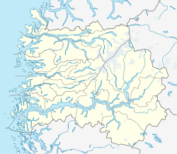
| Location in Sogn og Fjordane county | |
| Coordinates: 61°56′07″N 05°06′49″E / 61.93528°N 5.11361°ECoordinates: 61°56′07″N 05°06′49″E / 61.93528°N 5.11361°E | |
| Country | Norway |
| Region | Western Norway |
| County | Sogn og Fjordane |
| District | Nordfjord |
| Municipality | Vågsøy Municipality |
| Area | |
| • Total | 1.93 km2 (0.75 sq mi) |
| Elevation | 3 m (10 ft) |
| Population (2013) | |
| • Total | 3,242 |
| • Density | 1,680/km2 (4,400/sq mi) |
| Time zone | CET (UTC+01:00) |
| • Summer (DST) | CEST (UTC+02:00) |
| Post Code | 6700 Måløy |
Måløy (Norwegian pronunciation: [mɔːˈløʏ̯] (![]() listen), English approximation: maw-LAY) is a town and the administrative centre of the municipality of Vågsøy in Sogn og Fjordane county, Norway. Måløy is located on the southeastern side of the island of Vågsøy, about 3 kilometres (1.9 mi) northeast of the village of Holvika and about 6 kilometres (3.7 mi) south of the village of Raudeberg. The Måløy Bridge connects the town to the village of Degnepoll on the mainland. Sør-Vågsøy Church is located in Måløy.
listen), English approximation: maw-LAY) is a town and the administrative centre of the municipality of Vågsøy in Sogn og Fjordane county, Norway. Måløy is located on the southeastern side of the island of Vågsøy, about 3 kilometres (1.9 mi) northeast of the village of Holvika and about 6 kilometres (3.7 mi) south of the village of Raudeberg. The Måløy Bridge connects the town to the village of Degnepoll on the mainland. Sør-Vågsøy Church is located in Måløy.
Måløy is one of the most important fishing ports in the region. In 1997, Måløy was granted town status by the municipality. The 1.93-square-kilometre (480-acre) village has a population (2013) of 3,242; giving the village a population density of 1,680 inhabitants per square kilometre (4,400/sq mi).
...
Wikipedia

