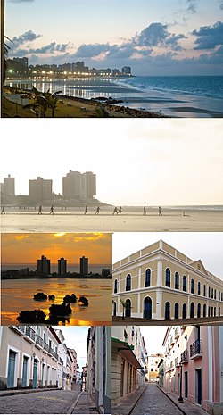
São Luís de Maranhão
| São Luís | |||
|---|---|---|---|
| Municipality | |||
|
The Municipality of São Luís do Maranhão |
|||
 |
|||
|
|||
 Location of São Luís |
|||
| Location in Brazil | |||
| Coordinates: 2°31′42″S 44°18′16″W / 2.52833°S 44.30444°W | |||
| Country |
|
||
| Region | Northeast | ||
| State |
|
||
| Founded | September 8, 1612 | ||
| Government | |||
| • Mayor | Edivaldo Holanda Júnior (PDT) | ||
| Area | |||
| • Municipality | 827.141 km2 (319.360 sq mi) | ||
| Elevation | 4 m (12 ft) | ||
| Population (2010 IBGE) | |||
| • Municipality | 1,011,943 | ||
| • Density | 1,183.4/km2 (3,064.9/sq mi) | ||
| • Metro | 1,227,659 | ||
| Time zone | UTC-3 (UTC-3) | ||
| Postal Code | 65000-000 | ||
| Area code(s) | +55 98 | ||
| Website | São Luís, Maranhão | ||
 |
|
| UNESCO World Heritage Site | |
|---|---|
| Location |
Brazil |
| Criteria | iii, iv, v |
| Reference | 821 |
| Coordinates | 2°31′48″S 44°18′10″W / 2.53°S 44.3028°W |
| Inscription | 1997 (21st Session) |
| Website | www |
|
[]
|
|
São Luís (Portuguese pronunciation: [sɐ̃w luˈis], Saint Louis) is the capital and largest city of the Brazilian state of Maranhão. The city is located on Ilha de São Luís (Saint Louis' Island) in the Baía de São Marcos (Saint Mark's Bay), an extension of the Atlantic Ocean which forms the estuary of Pindaré, Mearim, Itapecuru and other rivers. Its coordinates are 2.53° south, 44.30° west. The city proper has a population of some 986,826 people (2008 IBGE estimate). The metropolitan area totals 1,227,659, ranked as the 16th largest in Brazil.
São Luís, created originally as , is the only Brazilian state capital founded by France (see France Équinoxiale) and it is one of the three Brazilian state capitals located on islands (the others are Vitória and Florianópolis).
The city has two major sea ports: Madeira Port and Itaqui Port, through which a substantial part of Brazil's iron ore, originating from the (pre)-Amazon region, is exported. The city's main industries are metallurgical with Alumar, and VALE. São Luís is home of the Federal University of Maranhão.
...
Wikipedia


