Sânnicoară, Cluj
| Apahida | |
|---|---|
| Commune | |
 |
|
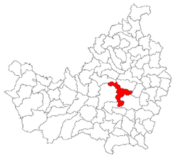
 Location of the settlement on Cluj County map |
|
| Location on Romania map | |
| Coordinates: 46°48′28″N 23°44′24″E / 46.80778°N 23.74000°ECoordinates: 46°48′28″N 23°44′24″E / 46.80778°N 23.74000°E | |
| Country |
|
| County | Cluj County |
| Status | Commune |
| Settled | 1263 |
| Commune seat | Apahida |
| Villages | Apahida, Bodrog, Câmpeneşti, Corpadea, Dezmir, Pata, Sânnicoară, Sub Coastă |
| Government | |
| • Mayor | Fărcaș Ionel (PSD) |
| Area | |
| • Total | 106.02 km2 (40.93 sq mi) |
| Population (July 1, 2007) | |
| • Total | 9,341 |
| • Density | 88/km2 (230/sq mi) |
| Time zone | EET (UTC+2) |
| • Summer (DST) | EEST (UTC+3) |
| Postal Code | 407035 |
| Area code(s) | +40 x64 |
| Website | http://www.cjcluj.ro/Apahida/ |
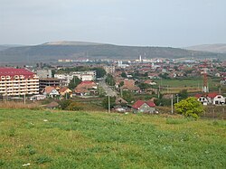
Apahida (Hungarian: Apahida; German: Bruckendorf; Latin: Pons Abbatis) is a commune in Cluj County, Romania. It is composed of eight villages: Apahida, Bodrog (Bodrog), Câmpenești, Corpadea (Kolozskorpád), Dezmir (Dezmér), Pata (Kolozspata), Sânnicoară (Szamosszentmiklós) and Sub Coastă (Telekfarka).
In 1889 and 1968 two rich archaeological treasures were discovered here. Apahida is also an important road junction in Cluj County, as it links Cluj County with Mureş County, through DN16. Also it provides quick access (approximately 20 minutes) from Cluj-Napoca to Băile Cojocna, famous for its salt waters and their curing properties.
According to the census from 2002 there was a total population of 8,785 people living in this town. Of this population, 91.17% are ethnic Romanians, 4.61% are ethnic Hungarians and 4.13% ethnic Romani.
...
Wikipedia

