Rutherford, New Jersey
| Rutherford, New Jersey | ||
|---|---|---|
| Borough | ||
| Borough of Rutherford | ||

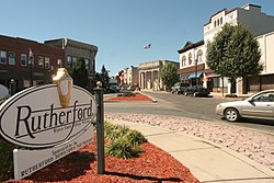
Welcome to Rutherford sign
|
||
|
||
| Nickname(s): "Borough of Trees" "First Borough of Bergen County" |
||
 Map highlighting Rutherford's location within Bergen County. Inset: Bergen County's location within New Jersey. |
||
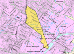
 Census Bureau map of Rutherford, New Jersey |
||
| Coordinates: 40°49′13″N 74°06′22″W / 40.820314°N 74.106041°WCoordinates: 40°49′13″N 74°06′22″W / 40.820314°N 74.106041°W | ||
| Country | ||
| State |
|
|
| County | Bergen | |
| Incorporated | September 21, 1881 | |
| Named for | John Rutherfurd | |
| Government | ||
| • Type | Borough | |
| • Body | November 14, 2015 | |
| • Mayor | Joseph DeSalvo Jr. (term ends December 31, 2019) | |
| • Administrator | Vacant (since May 2015) | |
| • Clerk | Margaret "Missy" Scanlon | |
| Area | ||
| • Total | 2.942 sq mi (7.618 km2) | |
| • Land | 2.806 sq mi (7.267 km2) | |
| • Water | 0.136 sq mi (0.352 km2) 4.61% | |
| Area rank | 337th of 566 in state 28th of 70 in county |
|
| Elevation | 66 ft (20 m) | |
| Population (2010 Census) | ||
| • Total | 18,061 | |
| • Estimate (2015) | 18,690 | |
| • Rank | 143rd of 566 in state 16th of 70 in county |
|
| • Density | 6,437.4/sq mi (2,485.5/km2) | |
| • Density rank | 73rd of 566 in state 21st of 70 in county |
|
| Time zone | Eastern (EST) (UTC-5) | |
| • Summer (DST) | Eastern (EDT) (UTC-4) | |
| ZIP code | 07070 | |
| Area code(s) | 201 | |
| FIPS code | 3400365280 | |
| GNIS feature ID | 0885383 | |
| Website | www |
|
Rutherford is a borough in Bergen County, New Jersey, United States. As of the 2010 United States Census, the borough's population was 18,061, reflecting a decline of 49 (−0.3%) from the 18,110 counted in the 2000 Census, which had in turn increased by 320 (+1.8%) from the 17,790 counted in the 1990 Census.
Rutherford was formed as a borough by an act of the New Jersey Legislature on September 21, 1881, from portions of Union Township, based on the results of a referendum held on the previous day. The borough was named for John Rutherfurd, a U.S. Senator who owned land in the area.
Rutherford has been called the "Borough of Trees" and "The First Borough of Bergen County".
The ridge above the New Jersey Meadowlands upon which Rutherford sits was settled by Lenape Native Americans long before the arrival of Walling Van Winkle in 1687. Union Avenue, which runs from the Meadowlands to the Passaic River, may have been an Indian trail, but was more likely a property boundary line; it was referenced in the 1668 grant of land by proprietary Governor Philip Carteret to John Berry.
During the early days of settlement, the land that is now Rutherford was part of New Barbadoes Township, as Berry had lived in Barbados, another English colony, before claiming his grant in New Jersey. New Barbadoes was part of Essex County from 1693 to 1710, when Bergen County was formed. In 1826, the land became part of Lodi Township (of which today's remaining portion is now South Hackensack). When Hudson County was formed in 1840, the area that is today North Arlington, Lyndhurst, Rutherford and East Rutherford became part of Harrison Township (of which today's remaining portion is Harrison town). However, the area reverted to Bergen County in 1852 and became known as Union Township.
...
Wikipedia

