Russellville, Ohio
| Russellville, Ohio | |
|---|---|
| Village | |
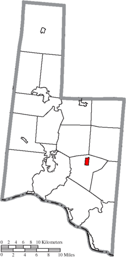
 Location of Russellville, Ohio |
|
 Location of Russellville in Brown County |
|
| Coordinates: 38°52′6″N 83°47′15″W / 38.86833°N 83.78750°WCoordinates: 38°52′6″N 83°47′15″W / 38.86833°N 83.78750°W | |
| Country | United States |
| State | Ohio |
| County | Brown |
| Township | Jefferson |
| Area | |
| • Total | 0.73 sq mi (1.89 km2) |
| • Land | 0.73 sq mi (1.89 km2) |
| • Water | 0 sq mi (0 km2) |
| Elevation | 961 ft (293 m) |
| Population (2010) | |
| • Total | 561 |
| • Estimate (2012) | 552 |
| • Density | 768.5/sq mi (296.7/km2) |
| Time zone | Eastern (EST) (UTC-5) |
| • Summer (DST) | EDT (UTC-4) |
| ZIP code | 45168 |
| Area code(s) | 937 |
| FIPS code | 39-69316 |
| GNIS feature ID | 1065263 |
Russellville is a village in Brown County, Ohio, United States. The population was 561 at the 2010 census.
Russellville was laid out in 1817 by Russell Shaw, and named for him.
Russellville corporation limit sign.
Looking east at the intersection of Main Street (Ohio Highway 125) and Columbus Street (US Highway 62) in Russellville.
Russellville Elementary School.
Grave of Russell Shaw, the founder of Russellville, in Shaw Cemetery.
Grave of Russell Shaw.
Grave of Russell Shaw.
Russellville is located at 38°52′6″N 83°47′15″W / 38.86833°N 83.78750°W (38.868338, -83.787610).
According to the United States Census Bureau, the village has a total area of 0.73 square miles (1.89 km2), all land.
Russellville Elementary School, the only school in the village, has approximately 480 pupils and 28 full-time staff.
As of the census of 2010, there were 561 people, 209 households, and 139 families residing in the village. The population density was 768.5 inhabitants per square mile (296.7/km2). There were 236 housing units at an average density of 323.3 per square mile (124.8/km2). The racial makeup of the village was 99.1% White, 0.5% African American, and 0.4% from two or more races. Hispanic or Latino of any race were 0.5% of the population.
...
Wikipedia
