Royersford, Pennsylvania
| Borough of Royersford | |
| Borough | |
|
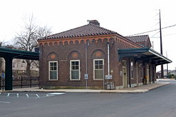
Royersford Station
|
|
| Country | United States |
|---|---|
| State | Pennsylvania |
| County | Montgomery |
| Elevation | 239 ft (72.8 m) |
| Coordinates | 40°11′07″N 75°32′16″W / 40.18528°N 75.53778°WCoordinates: 40°11′07″N 75°32′16″W / 40.18528°N 75.53778°W |
| Area | 0.7 sq mi (1.8 km2) |
| - land | 0.7 sq mi (2 km2) |
| - water | 0.0 sq mi (0 km2), 0% |
| Population | 4,752 (2010) |
| Density | 5,400.8/sq mi (2,085.3/km2) |
| Incorporated | 1879 |
| Government | Council-manager |
| Mayor | John Guest |
| Timezone | EST (UTC-5) |
| - summer (DST) | EDT (UTC-4) |
| ZIP Code | 19468 |
| Area code | 610 and 484 |
|
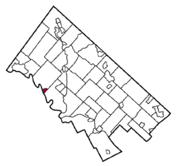
Location of Royersford in Montgomery County
|
|
|
Location of Pennsylvania in the United States
|
|
| Website: http://www.royersfordborough.org | |
Royersford is a borough in Montgomery County, Pennsylvania, 32 miles (51 km) northwest of Philadelphia, on the Schuylkill River.
The town drew its name from the location of a ford across the Schuylkill River, which happened to be adjacent to land owned by the Royer family. Early in the twentieth century, it had several stove factories, two glass and bottle works, hosiery and silk mills, a dye and bleaching plant, manufactories of bricks, gas meters, stockings, shirts, shafting parts, wagons, agricultural implements, etc. The population stood at 2,607 people in 1900, and at 3,073 in 1910. The population was 4,752 at the 2010 census. The borough was formed from the southeastern corner of Limerick Township in 1879. Royersford Borough is a member of the Spring-Ford Area School District.
The Continental Stove Works was added to the National Register of Historic Places in 1986.
Royersford is located at 40°11′7″N 75°32′16″W / 40.18528°N 75.53778°W (40.185239, -75.537648). The borough lies on the northern banks of the Schuylkill River, and is considered a suburb of Philadelphia.
According to the United States Census Bureau, the borough has a total area of 0.8 square miles (2.1 km2), of which, 0.8 square miles (2.1 km2) of it is land and 0.04 square miles (0.10 km2) of it (4.88%) is water.
As of the 2010 census, the borough was 89.7% White, 5.1% Black or African American, 0.2% Native American, 1.7% Asian, and 2.4% were two or more races. 4.2% of the population were of Hispanic or Latino ancestry [1].
...
Wikipedia


