Route 3 (MA)
| Route 3 | ||||
|---|---|---|---|---|
 |
||||
| Route information | ||||
| Maintained by MassDOT | ||||
| Length: | 55.7059 mi (89.6500 km) | |||
| Existed: | 1926 – present | |||
| Major junctions | ||||
| South end: |
|
|||
|
|
||||
| North end: |
|
|||
| Location | ||||
| Counties: | Barnstable, Plymouth, Norfolk, Suffolk, Middlesex | |||
| Highway system | ||||
|
||||
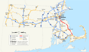
Route 3 is a southward continuation of U.S. Route 3, connecting Cambridge, Massachusetts with Cape Cod. All of it, except for the northernmost end in downtown Boston and Cambridge, is a Controlled-access highway.
The section from Boston to Braintree is also marked as Interstate 93 and U.S. Route 1 and is known in downtown Boston as the Central Artery, and south of downtown as the Southeast Expressway. In Braintree, I-93 and US 1 split to follow the Yankee Division Highway to Interstate 95, and Route 3 continues south on its own, as the Pilgrims Highway. This section extends to a junction with U.S. Route 6 in Sagamore, just before the Sagamore Bridge over the Cape Cod Canal where Route 3 originally ended at rotary. Replacement of this rotary with an elevated "flyover" interchange was completed in November 2006.
...
Wikipedia

