Sagamore Bridge
| Sagamore Bridge | |
|---|---|

Cape Cod Canal - Sagamore Bridge
|
|
| Coordinates | 41°46′34.14″N 70°32′36.13″W / 41.7761500°N 70.5433694°WCoordinates: 41°46′34.14″N 70°32′36.13″W / 41.7761500°N 70.5433694°W |
| Carries |
|
| Crosses | Cape Cod Canal |
| Locale | Sagamore, Massachusetts |
| Maintained by | U.S. Army Corps of Engineers |
| Characteristics | |
| Design | Arch bridge with suspended deck |
| Total length | 1,408 ft (429 m) |
| Width | 40 ft (12 m) |
| Longest span | 616 ft (188 m) |
| Clearance below | 135 ft (41 m) |
| History | |
| Construction begin | 1933 |
| Construction end | 1935 |
| Opened | June 22, 1935 |
| Statistics | |
| Toll | None |
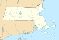
The Sagamore Bridge in Sagamore, Massachusetts carries U.S. Route 6 (US 6) across the Cape Cod Canal, connecting Cape Cod with the mainland of Massachusetts.
Most traffic approaching from the north follows Massachusetts Route 3 (Route 3), which ends at US 6, just north of the bridge, and the bridge provides direct expressway connections from Boston and Interstate 93 (I-93).
There is a sidewalk for pedestrian and bicycle access on the east side of the bridge.
During relatively high winds of 70 miles per hour (110 km/h) or above, due to bad weather, bridges to the Cape are sometimes closed for safety.
The bridge, along with its sibling, the Bourne Bridge, was constructed beginning in 1933 by the Public Works Administration for the U.S. Army Corps of Engineers, which operates both the bridges and the canal. Both bridges carry four lanes of traffic over a 616 feet (188 m) main span, with a 135 feet (41 m) ship clearance. They opened to traffic on June 22, 1935. The design of the Sagamore and Bourne bridges was later copied in miniature for the John Greenleaf Whittier Bridge that connects I-95 from Newburyport to Amesbury.
The new bridges replaced an earlier bridge, completed in 1912, which was built as a drawbridge before the canal was widened (and indeed before the canal opened in 1914, for obvious logistical reasons). The original bridge approaches are still visible to the north of the modern bridge, though both approaches are in low-traffic residential areas.
...
Wikipedia

